It’s the most popular waterfall in the Blue Ridge Mountains and for good reason. Linville Falls has it all. It’s easily accessible and with hikes that are good for all skill levels and there’s lots of beautiful scenery along the way. Here’s a complete guide on how to hike to Linville Falls from the visitor center covering all the trails there. You’ll have everything you need to know to prepare for your adventure.
How To Hike To Linville Falls And What To Expect There

Disclaimer
As an Amazon Associate, I earn from qualifying purchases. I am an affiliate with Booking.com and GoPro.
FAQ for hiking to Linville Falls
Where is it located?
Marion about 4 hours drive from Fayetteville.
How long does it take?
Depends on how many trails you do.
What skill level is required?
Beginner – some trails have incline sections but overall they are short and simple.
Is it kid friendly?
Yes. As always, you know your kids best so use this guide and your best judgment to decide what’s best for your family.
Is it dog friendly?
Yes, on a leash.
Can you swim at the waterfall?
No swimming is allowed.
What should you bring with you?
- Comfortable hiking shoes – these are my favorite beginner hiking shoes
- Water
- Sun protection
- Snacks or energy gels – I always have a couple of these with me
- Camera – this is my favorite adventure camera and I use it with this compact selfie stick and tripod
How to get there and parking
You can use ‘Linville Falls Visitor Center‘ in Google Maps and it will take you to the free parking lot.
It’s easy to find as you get close because there are signs to follow but it might also be worthwhile downloading the area to offline maps before you go in case you lose cell service.
The parking area is quite large so there’s ample room to find a spot.
It’s the most popular waterfall in the Blue Ridge Mountains and that popularity comes with a crowd. If you’d like to avoid the crowds, it would be best to go on a weekday. However if that’s not possible, just be prepared to share the trails with other nature lovers.
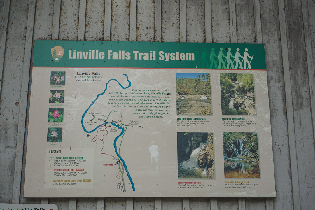
Map at the visitor center
The Linville Falls Visitor Center
Before you start hiking, you have the visitor center right there with lots of information about the area.
If it’s open you can chat to a ranger and pick up a map.
Otherwise there are maps on the outside wall which you can take a photo of to keep on track if the visitor center is closed. The trails are very well maintained and easy to follow, but maps are always handy to have.
While the visitor center is open, there are toilet facilities at the building. However I also visited when it was closed and there were Porta John toilets placed nearby.
Where to start
This depends on which trail you want to do. But, either way, you’ll be starting from the visitor center area. I’ll give you guide and photos for both options below too.
If you just want to take a quick trail to see the waterfall, I’d recommend Erwin’s View Trail.
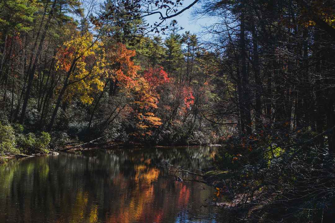
For something a little more strenuous with upper and lower waterfall views, I’d recommend the Linville Gorge Trail. It also has a spin off trail that goes down quite close to the base of the falls.
You could easily do both sides in one day if you want.
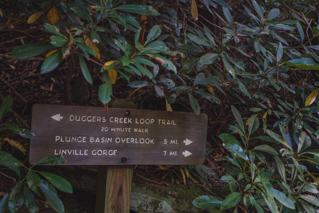
It’s well signed and easy to follow
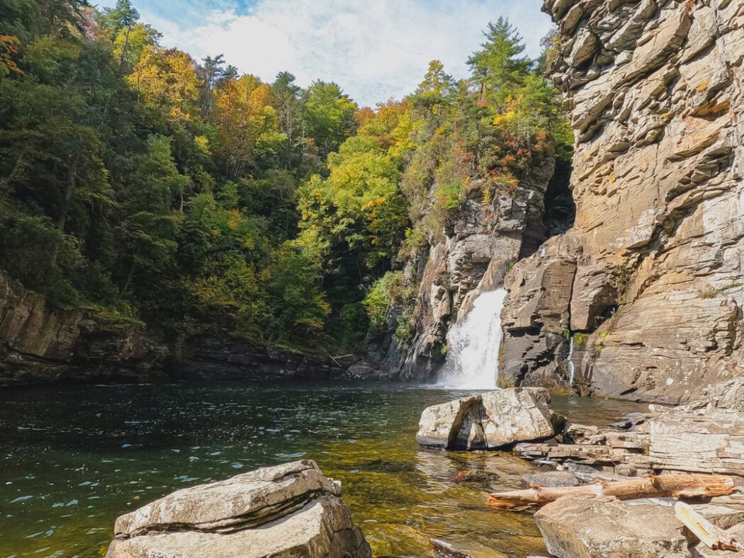
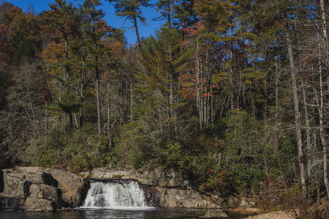
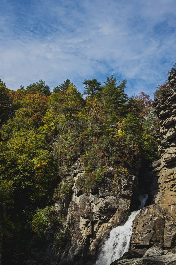
Linville Gorge Trail
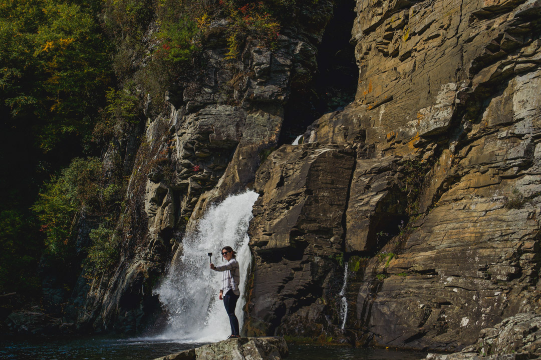
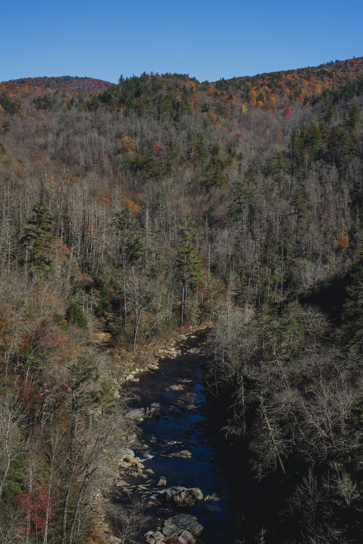
On the Linville Gorge Trail you can see the upper views of the falls from the opposite side as well as take the Plunge Basin Trail all the way down next to the falls.
You can’t swim there but it’s cool to get the close up view.
The park lists it as strenuous and, of course it’s subjective, but I’d say that’s making it sound a lot more dramatic than it is.
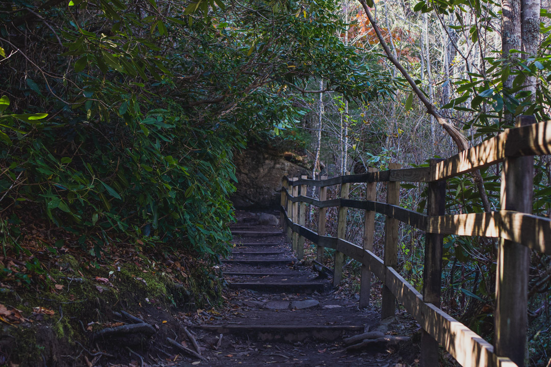
Going uphill is always tough and some of the trail to the basin is larger rocks so a little leg strength is required as you go up them. Overall though, it’s not too strenuous if you have a decent level of fitness. I saw a few families with kids and people of all ages on the trail while I was there.
If you are really out of shape or have knee issues, it might be worth skipping.
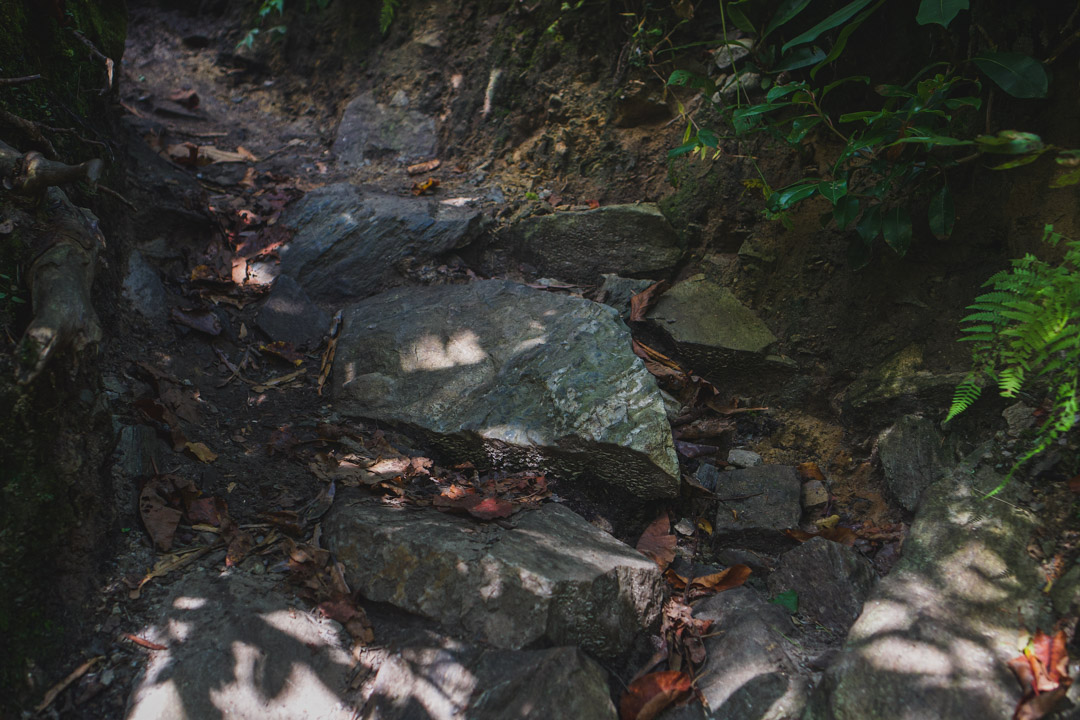
Some of the trail down to the bottom of the falls – this is what I mentioned about climbing up rocks

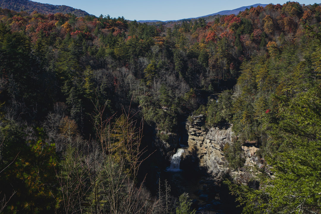
Erwin’s View Trail
Erwin’s View Trail has a few different options as far as how long you want to go, but the total trail is 1.6 miles in total.
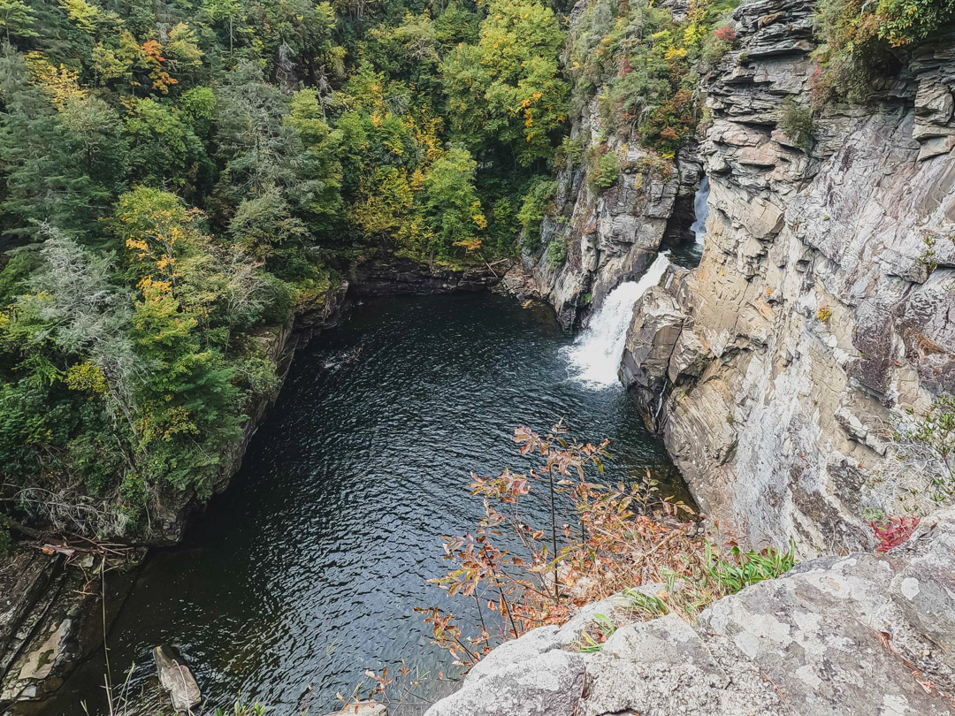
If you only want to see the falls, you can do that and turn around. There’s a really nice viewing area to get your waterfall fix.
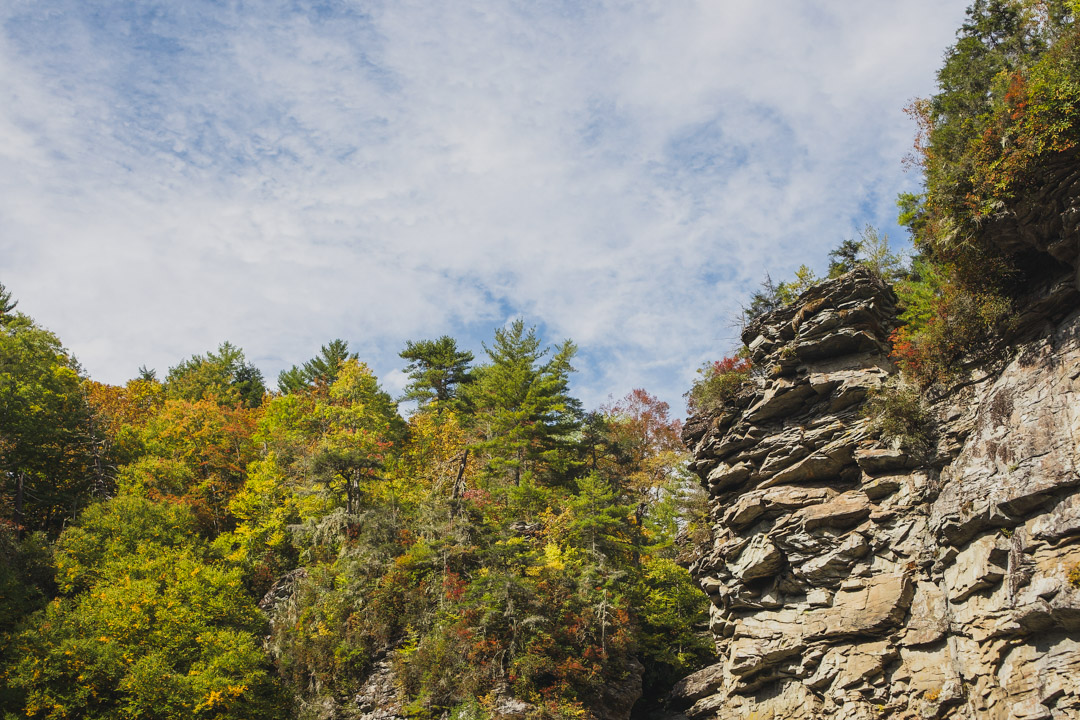
You can also continue on to see all the different views of the falls. There are four lookout points in total and the panoramic views at the last one are worth it!
The whole trail is easy with an incline being the only challenging aspect. However, if you feel puffed out, there’s plenty of room to step to the side and catch your breath.
There is a narrow part of the trail just before the first waterfall viewing area that only fits one way traffic. Just keep in mind there might be a wait in that spot if it’s crowded.
This is the narrow section I mentioned where you might have to wait a little
How to make it a weekend trip
Since it’s a long drive from Fayetteville for a day trip, Linville Falls is a good adventure to add into a weekend trip to the mountains.
Banner Elk is a great base for the weekend and I have a full guide on how to plan a weekend trip to Banner Elk here.
This is the vacation home I stayed in and it was awesome (and pet friendly!)
I’ve also stayed here at Sugar Mountain which is nearby and would make a good base for the weekend.
Both are close to a lot of other outdoor adventures to make it easy to maximize your time on your trip.
Other guides you might enjoy
How To Hike Profile Trail To MacRae Peak On Grandfather Mountain
Your Complete Guide On How To Spend A Weekend In Maggie Valley, NC
A Detailed Guide On How To Find The Waterrock Knob Plane Crash
What To Bring On A Short Hike – Essentials To Always Have On You
If you found this useful, return the favor by sharing it or following me on Instagram!
How long would it take approximately to hike both?
Not sure exactly but they weren’t too long
… [Trackback]
[…] Find More Information here on that Topic: thekatieshowblog.com/how-to-hike-to-linville-falls/ […]
… [Trackback]
[…] Read More on that Topic: thekatieshowblog.com/how-to-hike-to-linville-falls/ […]
… [Trackback]
[…] There you can find 73816 more Information on that Topic: thekatieshowblog.com/how-to-hike-to-linville-falls/ […]
… [Trackback]
[…] There you can find 85215 additional Info on that Topic: thekatieshowblog.com/how-to-hike-to-linville-falls/ […]
… [Trackback]
[…] Read More on on that Topic: thekatieshowblog.com/how-to-hike-to-linville-falls/ […]
… [Trackback]
[…] Here you will find 79886 additional Information to that Topic: thekatieshowblog.com/how-to-hike-to-linville-falls/ […]
… [Trackback]
[…] Read More Information here to that Topic: thekatieshowblog.com/how-to-hike-to-linville-falls/ […]
… [Trackback]
[…] Find More to that Topic: thekatieshowblog.com/how-to-hike-to-linville-falls/ […]
… [Trackback]
[…] Info on that Topic: thekatieshowblog.com/how-to-hike-to-linville-falls/ […]
… [Trackback]
[…] There you can find 90605 more Information on that Topic: thekatieshowblog.com/how-to-hike-to-linville-falls/ […]
… [Trackback]
[…] Find More here on that Topic: thekatieshowblog.com/how-to-hike-to-linville-falls/ […]
… [Trackback]
[…] Find More to that Topic: thekatieshowblog.com/how-to-hike-to-linville-falls/ […]
… [Trackback]
[…] Find More to that Topic: thekatieshowblog.com/how-to-hike-to-linville-falls/ […]
… [Trackback]
[…] Find More on that Topic: thekatieshowblog.com/how-to-hike-to-linville-falls/ […]
… [Trackback]
[…] Read More Info here on that Topic: thekatieshowblog.com/how-to-hike-to-linville-falls/ […]
… [Trackback]
[…] Find More Info here on that Topic: thekatieshowblog.com/how-to-hike-to-linville-falls/ […]
… [Trackback]
[…] Read More on to that Topic: thekatieshowblog.com/how-to-hike-to-linville-falls/ […]
… [Trackback]
[…] Find More on on that Topic: thekatieshowblog.com/how-to-hike-to-linville-falls/ […]
… [Trackback]
[…] Info on that Topic: thekatieshowblog.com/how-to-hike-to-linville-falls/ […]
… [Trackback]
[…] Info to that Topic: thekatieshowblog.com/how-to-hike-to-linville-falls/ […]
… [Trackback]
[…] Read More on that Topic: thekatieshowblog.com/how-to-hike-to-linville-falls/ […]
… [Trackback]
[…] Read More here to that Topic: thekatieshowblog.com/how-to-hike-to-linville-falls/ […]
… [Trackback]
[…] Info to that Topic: thekatieshowblog.com/how-to-hike-to-linville-falls/ […]