
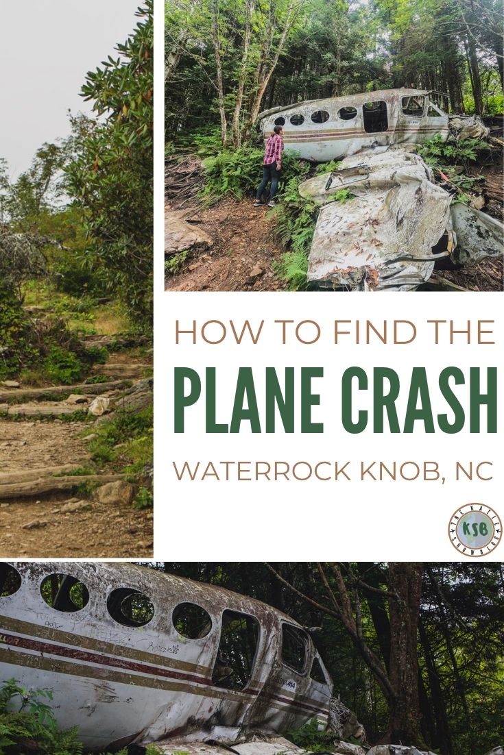
In November of 1983, a combination of poor weather and alcohol led to the crash of a small Cessna 414A plane, killing all on board. The wreckage still lies in the quiet mountains where it landed, leaving a unique site for hikers. Here’s my full guide on how to hike to the Waterrock Knob plane crash with everything you need to know to plan your outing.
Waterrock Knob Plane Crash – Here’s A Step By Step Hiking Guide
Disclaimer
There are affiliate links included in this post. This means at no extra cost to you, I earn a commission if you book through the link.
FAQ for hiking to the Waterrock Knob plane crash
Where is it located?
Maggie Valley, about 5 hours from Fayetteville.
How long is the hike?
About 2 hours return depending on your pace. The hike is about 2 miles long.
What skill level is required?
Intermediate.
There’s more details below so please read the full guide to see if it’s a good option for you.
In my opinion the trail is intermediate because it’s unmaintained so you are hiking over a lot of tree roots and it requires more awareness to keep on track.
What type of trail is it?
Point to point with a paved section as well as a dirt and tree root based section.
Is it dog friendly?
Yes, depending on your dog of course.
Is it kid-friendly?
Yes. Of course, you know your kids best so use this guide and your best judgment to decide if it’s appropriate for yours.
What should you bring with you?
- Good hiking shoes – these are my favorite beginner hiking shoes for slippery hikes like this otherwise whatever hiking shoes you prefer and appropriate for the weather of the season
- Water
- Snacks – I like to have a couple of these energy gels with me when I hike
- A good action camera – I always have this on me with this selfie stick and tripod combo
- Sun protection
- Epic Wipes for wiping the mud off afterward

Where to park for the Waterrock Knob Plane Crash hike
You can use ‘Waterrock Knob Visitor Center‘ in Google Maps to get to the parking area.
GPS coordinates: 35°27’37.2″N 83°08’27.0″W
There’s a large free parking area, visitor center for more information on the area, and some beautiful views here so it’s worth checking out.
There are also restrooms by the visitor center which is your last chance to go before you start hiking.

The visitor center building with restrooms in the building on the left

This sign points out the start of the trail
Where to start the Waterrock Knob plane crash trail
To start the trail, you simply follow the hike to Waterrock Knob.
If you are facing the visitor center, the trail follows an incline on the right. It’s a paved path and well signed so all you need to do is look out for it.
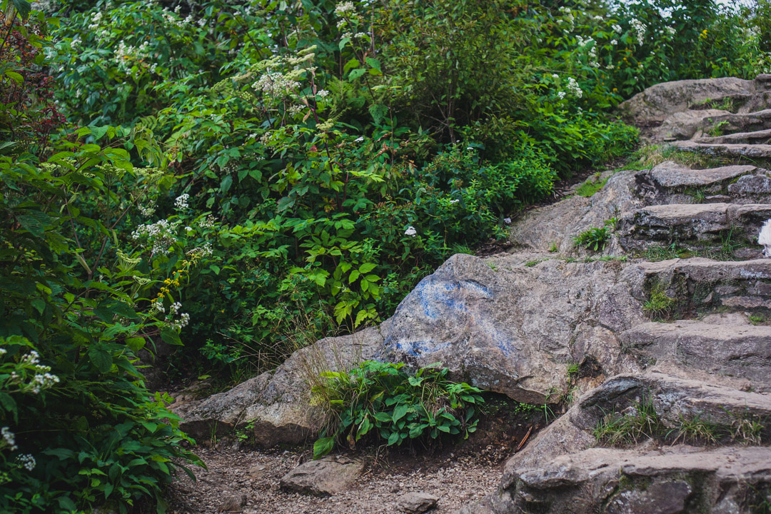
This popular trail goes to the Waterrock Knob summit. It begins as a paved trail, then moves to a dirt and rocky trail, and there are a few small sections with stairs. This one is a fairly easy trail in terms of skill.
The thing about getting to any summit is that you gotta go uphill. It’s going to work your legs.
But, it’s a wide trail with plenty of room to stop and catch your breath if you need to.
If you’re not a confident hiker but still want to explore the area, maybe just do this trail to the summit.
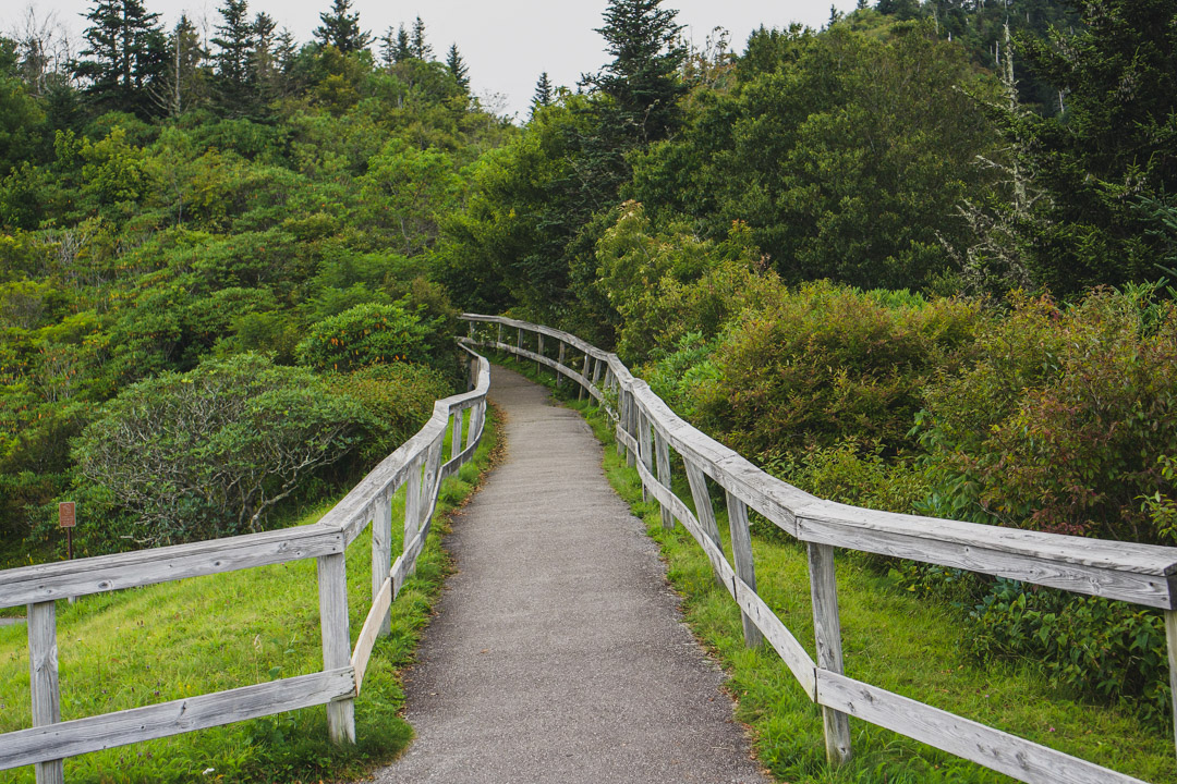
Start of the trail
The trail begins as a paved path then turns into a rocky dirt trail
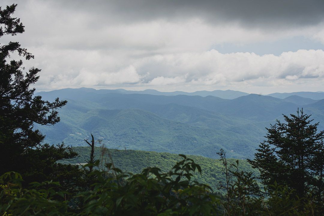
Views at the Waterrock Knob summit
How to start the trail to the plane crash
The trail starts at the last path on the left before the summit. I recommend going to the summit first to check out the views, then going to the plane crash after.
When you start returning back down the trail from the summit, you’ll see the small plane crash trail on your right. If you are walking uphill as opposed to returning from the summit, it will be on the left.
There’s no sign as it’s unmaintained, but when I did it there was an arrow spray painted on a rock. Just keep an eye out for the small path.
Since it is unmaintained, it might be worth asking at the visitor center for any current updates or safety tips for the time you are visiting.
Just before the summit, you will see the path to the plane crash on the left. This spray painted rock points the way
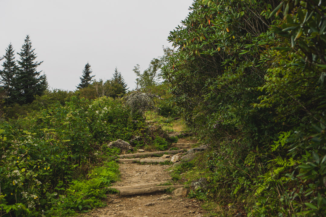
Hiking terrain

What to expect on the Waterrock Knob plane crash trail
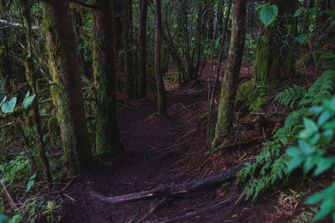
Once you are off the main paved trail, it turns into more of an intermediate hike.
I think the challenges with this hike are because you need to be more alert for markings to stick to the trail and because the terrain can be a little slippery, requiring a little more skill than walking a paved trail.
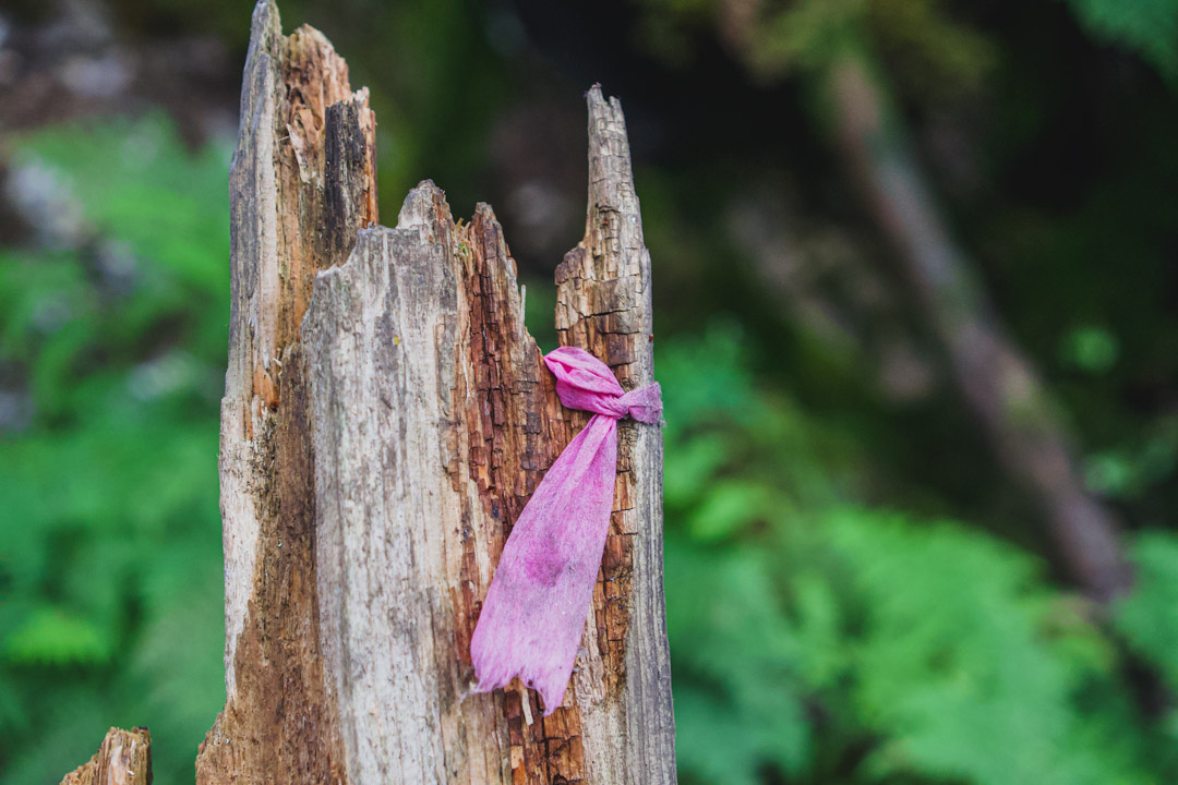
There were some trail markers tied to trees, but they weren’t as reliable because some had been blown away in storms. I found it easier to follow the spray paint on trees and rocks to stay on the trail.
It was also pretty easy to follow the well worn path just by looking as well, but the spray painted markings definitely made it easier.
There’s a lot of ups and downs so you’ll probably get a little puffed on the incline, but if you have a reasonable level of fitness, you should be fine.
I saw families with kids doing the trail while I was there and people with dogs – I took my dog too.
It can be muddy and slippery if it’s been raining, so just take your time as you walk over the tree roots.
In my blog I never try and say whether you should or shouldn’t do a hike. I just give you as much information as possible to make that decision for yourself and I hope that helps.
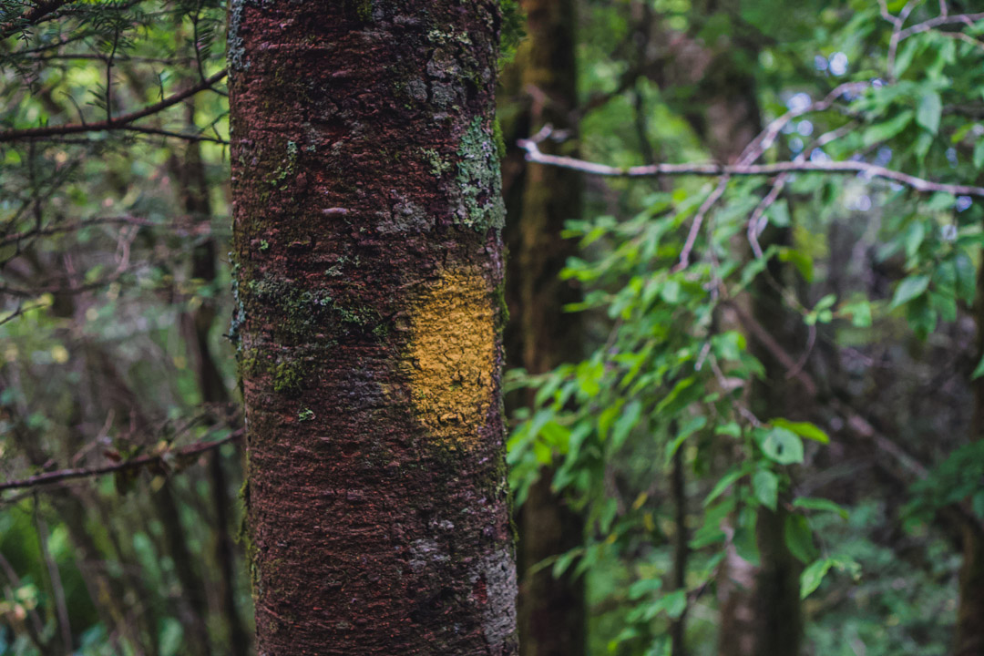
I found the spray paint trail markings most helpful since some of the ties had been blown away in storms
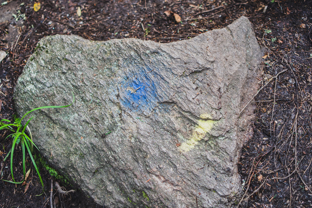

When you come to this clearing, take the path left (this spray painted rock points the way) and you are very close to the crash
The plane crash site
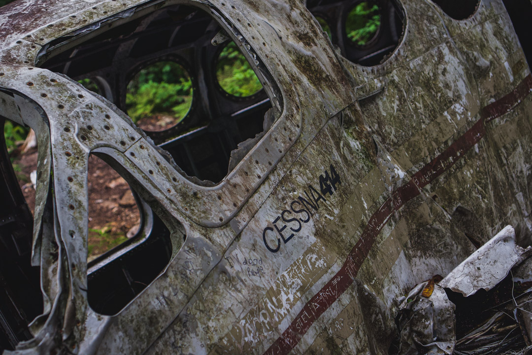
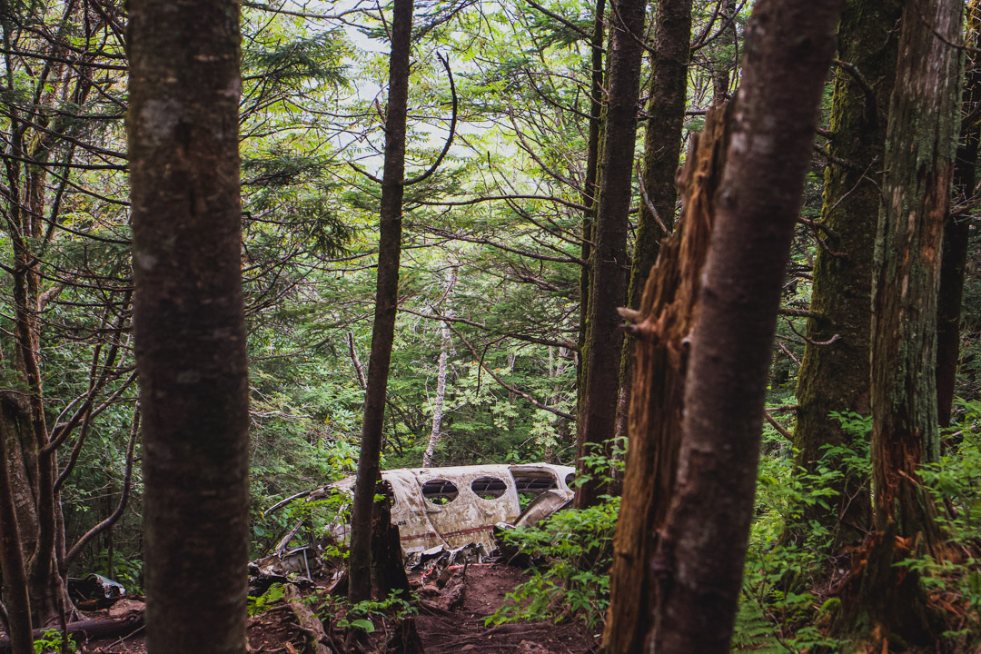
You will be walking through the quiet woods then all of a sudden the crash appears through the trees.
It has a bit of ‘wow’ factor yet it’s eerie all at once.
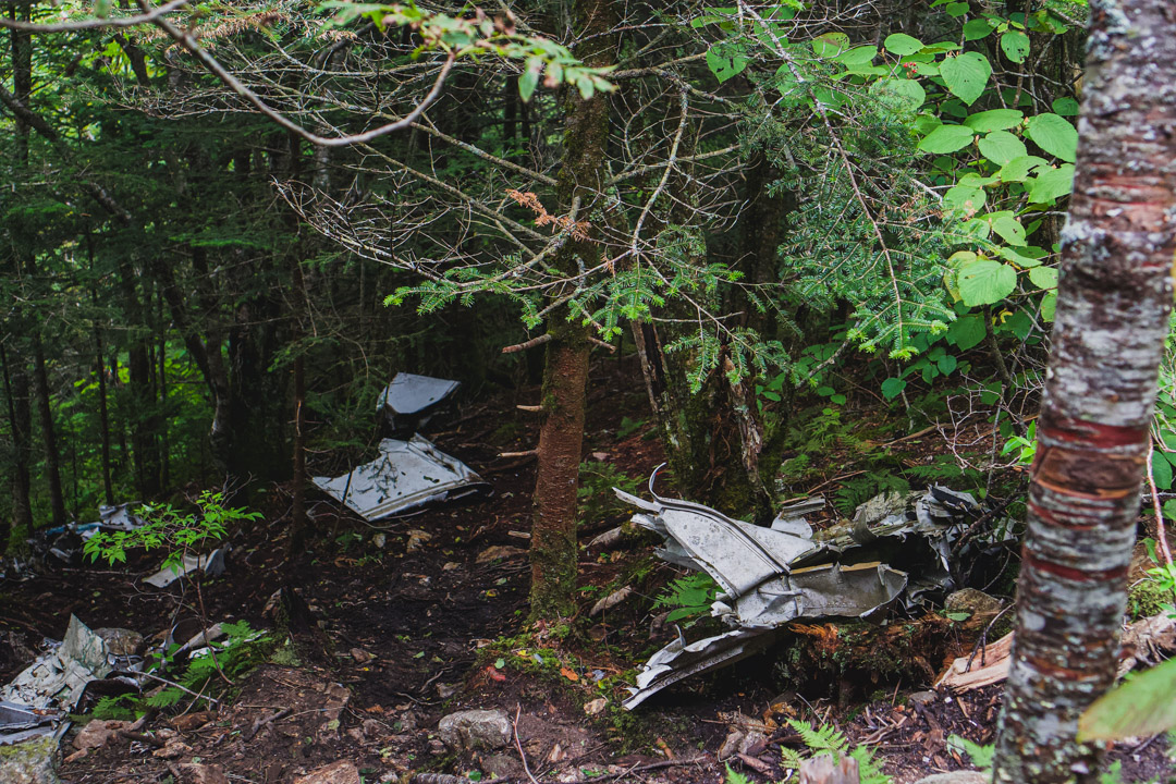
The crash lays there as it landed with frayed cords and broken windows serving as a reminder of the final journey. If you look around you’ll see bits of wreckage spread around the area as well.
It’s not something you would climb in or on, but it is interesting to see and take some photos of.
You probably don’t need to reminder, but keep in mind it is a site where people died so keep it respectful when you visit.


Where to stay near Waterrock Knob
If you’re planning to make this a weekend trip, I recommend searching on Booking.com to choose a place. That’s what I usually use to book accommodation when I travel and I can always find a good deal there.
I stayed here and it was just awesome. It was fantastic to have breakfast on the porch, sit by the fire in the evenings, and soak in the jacuzzi at night while watching glow bugs.
10/10 recommend it as a place to stay, and, wherever you choose, Maggie Valley is a great base for your adventures.
Other guides you might enjoy
Where To Swim At Jordan Lake, NC – Complete Beach Hopping Guide
Glamping In North Carolina – Here’s How To Plan Your Off The Grid Adventure
Here’s Why You Gotta Visit The World’s Largest Strawberry Building In NC
If you found this useful, return the favor by sharing it or following me on Instagram!
Thank you for the detailed guide!
You’re welcome, thanks for reading it!
Thank you for the helpful tips!
Thanks for reading it!
Unfortunately, since the internet has connected everyone. People are going there and tagging it with spray paint and being disrespectful as many people in the states are.
True! I heard it might even be getting removed soon because of it. Shame how some ruin it for everyone
Oh the main graffiti tag is coming off tomorrow.
You said in your writing of finding plane. It’s not right off the side after the knob and it’s NOT.. And it’s very very difficult and could take hours. Especially for people that think it’s a hour hike …People ruin a lot of stuff but the tagging doesn’t seem to take away the fact it’s a plane way way way out in the woods. That’s not very clearly marked…Thanks for trying to help with your big write up that didn’t help much … thanks
Hi Ace, it seems you might’ve mixed up what I’ve written because I never said it’s on the right after the knob. It clearly says it’s on the right if you are returning down the trail after the lookout.
You clearly didn’t follow the directions… lol
Amen.
Thanks for the guidance on this blog. Very helpful. My son and I did it a couple of days ago but the wreckage has been removed.
Oh that’s a shame but glad you guys still got out there to hang out in nature
The plane debris was removed from the site in the spring of 2023. There is no longer anything to see.
Oh damn, that’s a shame
… [Trackback]
[…] Find More Information here to that Topic: thekatieshowblog.com/waterrock-knob-plane-crash/ […]
… [Trackback]
[…] Find More Information here on that Topic: thekatieshowblog.com/waterrock-knob-plane-crash/ […]
… [Trackback]
[…] Information on that Topic: thekatieshowblog.com/waterrock-knob-plane-crash/ […]
… [Trackback]
[…] Find More Info here to that Topic: thekatieshowblog.com/waterrock-knob-plane-crash/ […]
… [Trackback]
[…] Information on that Topic: thekatieshowblog.com/waterrock-knob-plane-crash/ […]
… [Trackback]
[…] Read More on that Topic: thekatieshowblog.com/waterrock-knob-plane-crash/ […]
… [Trackback]
[…] Here you will find 84907 more Info on that Topic: thekatieshowblog.com/waterrock-knob-plane-crash/ […]
… [Trackback]
[…] Read More Info here to that Topic: thekatieshowblog.com/waterrock-knob-plane-crash/ […]
… [Trackback]
[…] Info to that Topic: thekatieshowblog.com/waterrock-knob-plane-crash/ […]
… [Trackback]
[…] Find More Info here on that Topic: thekatieshowblog.com/waterrock-knob-plane-crash/ […]
… [Trackback]
[…] Info to that Topic: thekatieshowblog.com/waterrock-knob-plane-crash/ […]
… [Trackback]
[…] Here you can find 46165 additional Information to that Topic: thekatieshowblog.com/waterrock-knob-plane-crash/ […]
… [Trackback]
[…] Read More here to that Topic: thekatieshowblog.com/waterrock-knob-plane-crash/ […]
… [Trackback]
[…] There you will find 27237 additional Information on that Topic: thekatieshowblog.com/waterrock-knob-plane-crash/ […]
… [Trackback]
[…] Find More Info here to that Topic: thekatieshowblog.com/waterrock-knob-plane-crash/ […]
… [Trackback]
[…] Read More Info here on that Topic: thekatieshowblog.com/waterrock-knob-plane-crash/ […]
… [Trackback]
[…] Find More Information here to that Topic: thekatieshowblog.com/waterrock-knob-plane-crash/ […]
… [Trackback]
[…] Find More here to that Topic: thekatieshowblog.com/waterrock-knob-plane-crash/ […]
… [Trackback]
[…] Find More on that Topic: thekatieshowblog.com/waterrock-knob-plane-crash/ […]
… [Trackback]
[…] Read More to that Topic: thekatieshowblog.com/waterrock-knob-plane-crash/ […]
… [Trackback]
[…] Read More here to that Topic: thekatieshowblog.com/waterrock-knob-plane-crash/ […]
… [Trackback]
[…] Info to that Topic: thekatieshowblog.com/waterrock-knob-plane-crash/ […]
… [Trackback]
[…] Find More Info here on that Topic: thekatieshowblog.com/waterrock-knob-plane-crash/ […]
… [Trackback]
[…] Read More here on that Topic: thekatieshowblog.com/waterrock-knob-plane-crash/ […]
… [Trackback]
[…] Info to that Topic: thekatieshowblog.com/waterrock-knob-plane-crash/ […]
… [Trackback]
[…] There you will find 45471 more Info to that Topic: thekatieshowblog.com/waterrock-knob-plane-crash/ […]
… [Trackback]
[…] Find More here to that Topic: thekatieshowblog.com/waterrock-knob-plane-crash/ […]
… [Trackback]
[…] Find More to that Topic: thekatieshowblog.com/waterrock-knob-plane-crash/ […]
… [Trackback]
[…] Here you will find 51759 additional Info to that Topic: thekatieshowblog.com/waterrock-knob-plane-crash/ […]
… [Trackback]
[…] Info to that Topic: thekatieshowblog.com/waterrock-knob-plane-crash/ […]
… [Trackback]
[…] Find More here to that Topic: thekatieshowblog.com/waterrock-knob-plane-crash/ […]
… [Trackback]
[…] Info to that Topic: thekatieshowblog.com/waterrock-knob-plane-crash/ […]