Mountain hike – check. Awesome views – check. Full-day adventure – check. Mountain cows – check. This hike has got it all. Here’s a detailed guide on how to hike Cima Portule in Asiago with everything you need to know to plan your adventure. It’s a popular hike that makes for a great day trip when you just want to get away from it all and climb a mountain. Everyone has those days, right?
A Detailed Guide On How To Hike Cima Portule In Asiago
Disclaimer
There are affiliate links included in this post. This means at no extra cost to you, I earn a commission if you book through the link.
FAQ for hiking Cima Portule
Where is it located?
Asiago about an hour and a half from Ederle.
How long does it take?
Between 5-7 hours depending on your pace.
What type of trail is it?
Point to point or loop.
What skill level is required?
Skill – beginner. Endurance – intermediate.
Are dogs allowed?
Yes.
Is it kid-friendly?
Yes – as always, it depends on your kids. You know them best, so use the guide to determine if it’s suitable for yours.
What should you bring with you?
- Snacks/lunch/energy gels – I always take a couple of these with me
 when I hike
 - Water
- Comfortable shoes
- Sun protection
- Camera – GoPro is my fav action camera for adventures and I use it with this compact selfie stick and tripod combo
- Light jacket
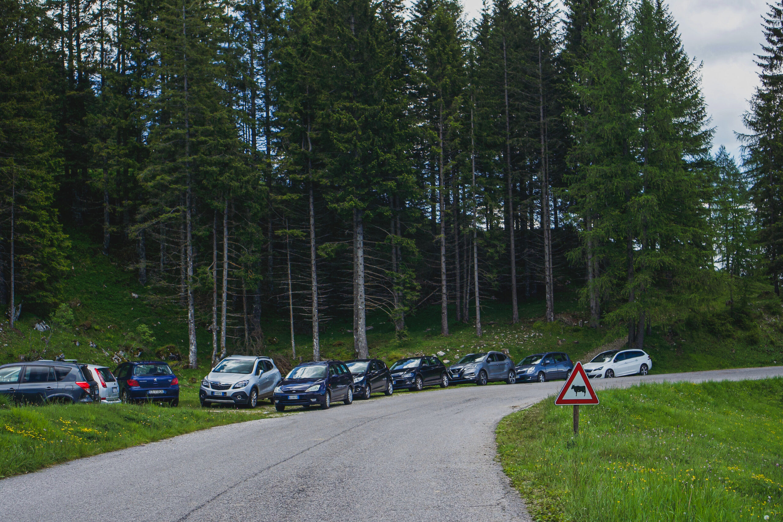
One of the parking areas on the side of the road
Where to park
You can use ‘Cai 826 Cima Portule’ in Google Maps to get to the trailhead.
Once you get there, it’s a matter of finding street parking in one of the areas of the side of the road in the area. I found parking closer to Rifugio Larici da Alessio and walked over to the start of the trail.
Another option is to park at Malga Larici di Sotto, but unless you’re going to stop there to buy something – you can get a meal or some farm fresh Asiago cheese, it’d be douchey to take up their parking spots.
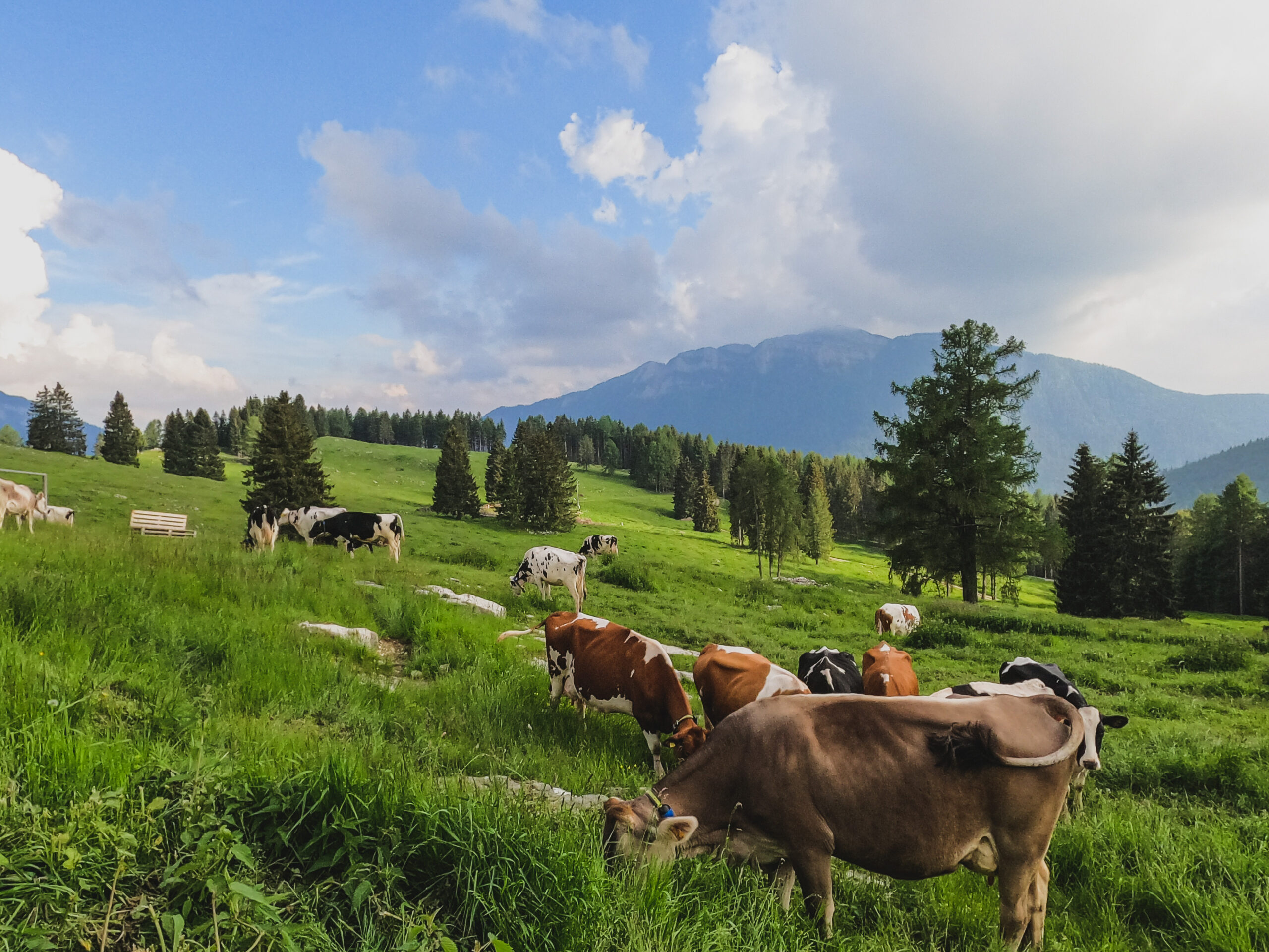
You might also get lucky to spot their dairy cows here or around the lower area of the trail.
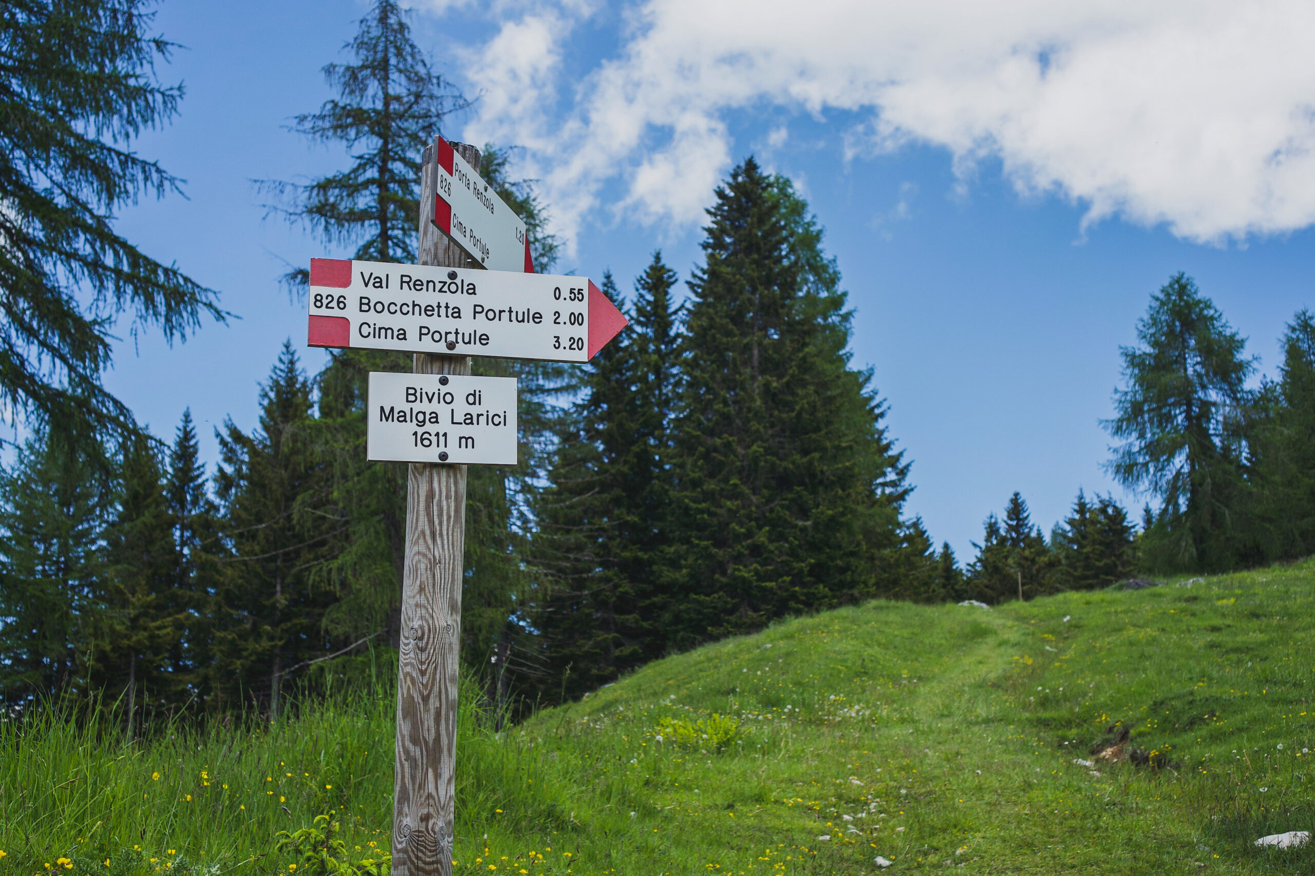
The lower section of the trail to hike to Cima Portule
Where to hike
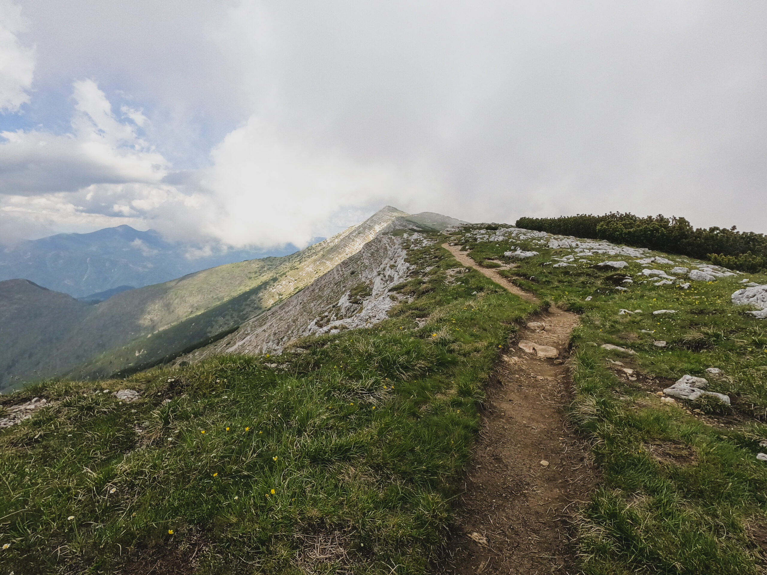
For the trail, walk on the road past Malga Larici di Sotto. The road ends and turns into the 826 trail.
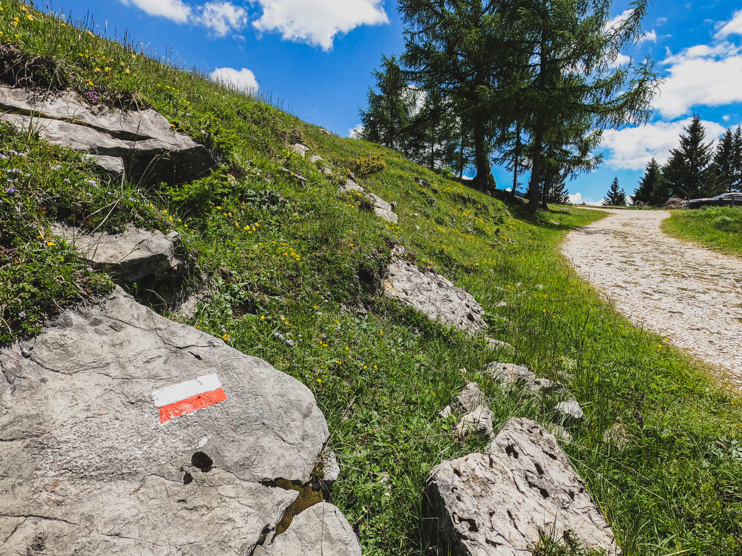
You basically follow that all the way up to the mountain peak and it’s well signed along the way.
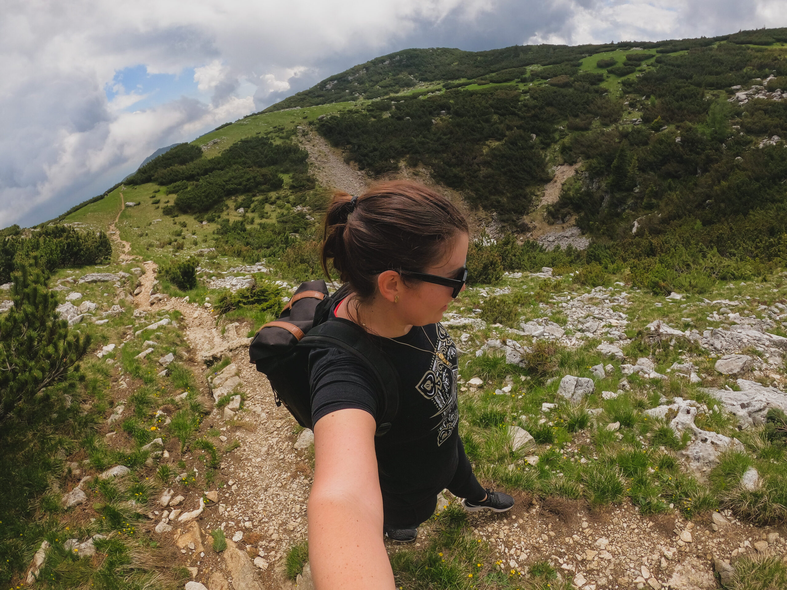
The trail is steep in sections, you are climbing to the top of a mountain after all, but it’s a slow and gradual type of steepness for the most part.
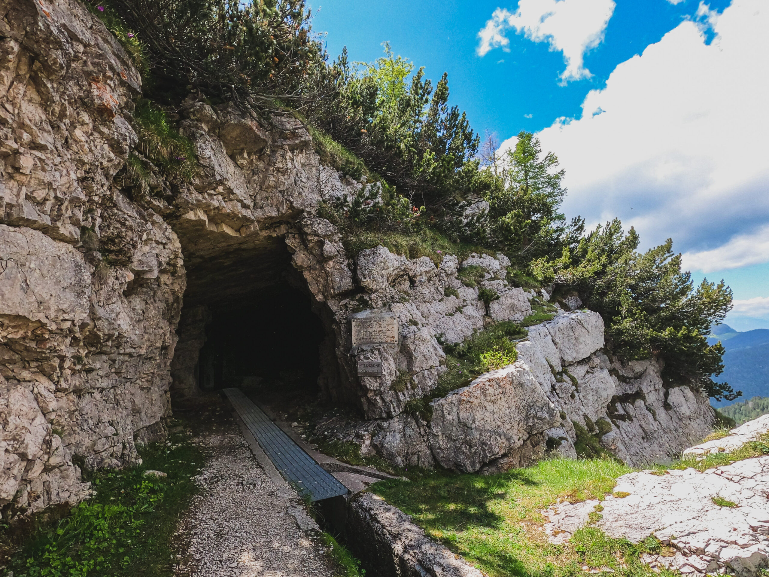
There’s one spot where you can walk through tunnels in a fort and there is a monument nearby this as well. When you are standing with the fort on your right and monument on your left, you’ll take the path up to the left.
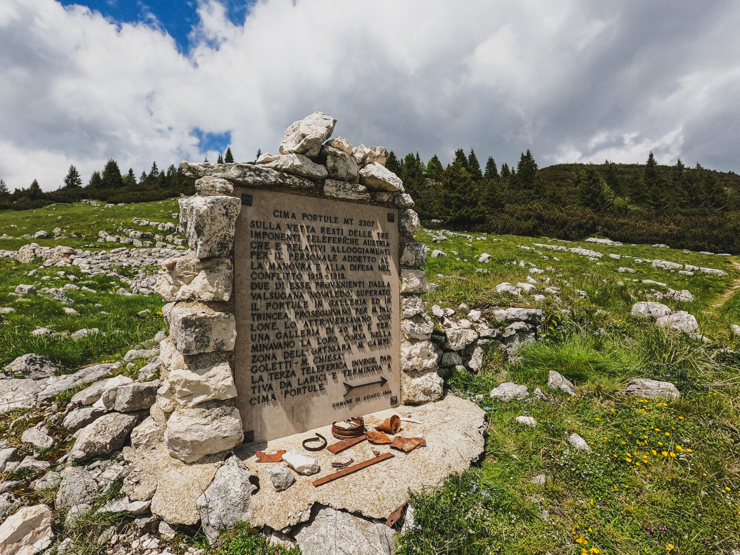
This is the monument I mentioned and you can see the path you follow on the right side of the photo
A little after this there was one section that didn’t have a sign, or at least I didn’t see it. In this part, the trail turned into a steeper section up to the left and I’ll add a photo so you know what to look out for.
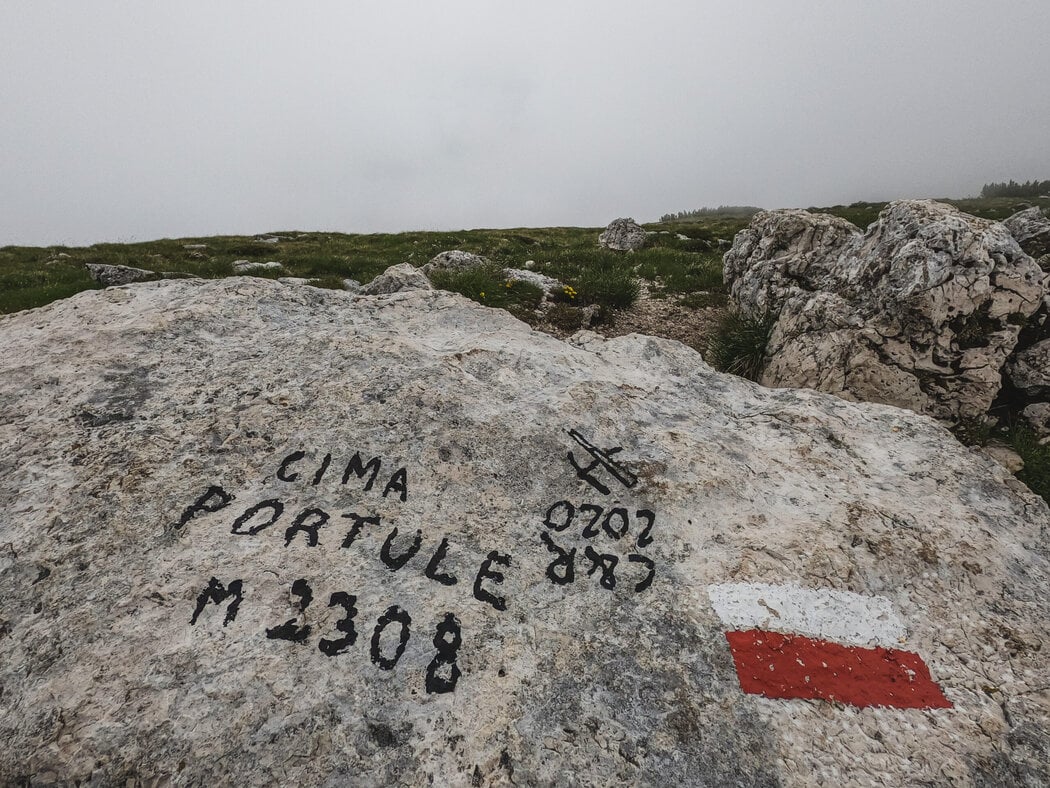
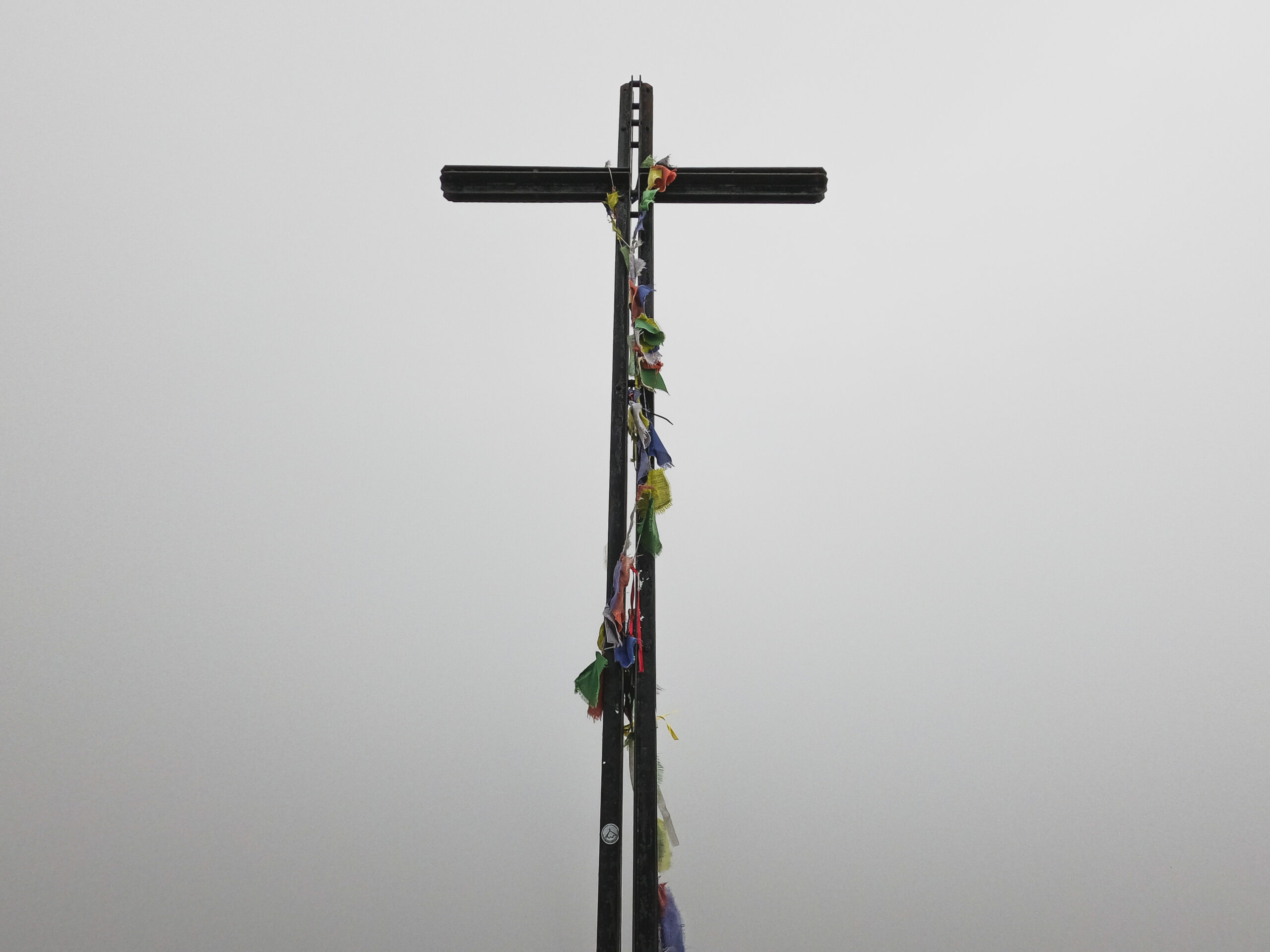
Once you get to the top you will see a cross and a lot of picturesque 360-degree views of the gorgeous scenery. There’s a lot of room at the top to stop for a picnic as well as a lot of other wide-open areas to rest along the trail.
From the top, you can go back the way you came to do this as a point to point trail or take the trail down the other side to make it a loop hike.
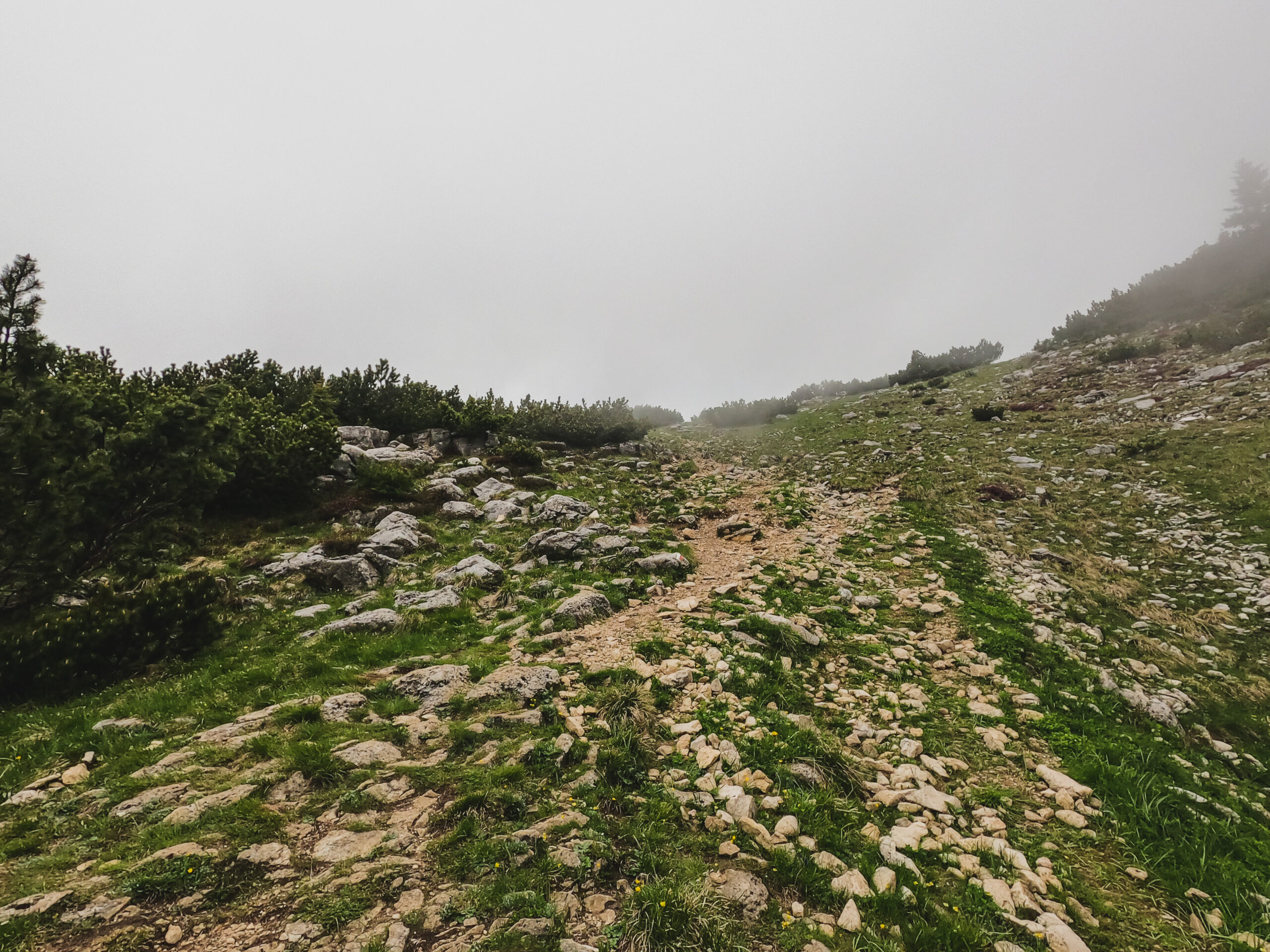
This is the section I mentioned where you take the steep trail to the left but there wasn’t a sign
What to expect on the Cima Portule hike
It’s a very easy trail as far as hiking skill is concerned because the trail is easy to follow, there aren’t any slippery sections, ropes to climb, or challenging things like that.
It’s a mixed terrain hike with sections of gravel, rocks, and dirt.
It is quite long though and can kick your butt in terms of endurance. If you’ve got a basic level of fitness, you’ll be fine and if you’ve done 52 Tunnels, you can do this one.
Just a good reminder to head up early and allow plenty of time to finish it before it gets dark. There are a lot of places to stop for rest or a picnic along the way, so it’s a nice trail to pack a lunch and make a full day of it.
I came across one section where snow was covering the trail and for this part, I just walked up and over around the snow so I didn’t have to go through it.
Safety tips for hiking the Cima Portule trail
It’s a long hike and fairly open to the elements most of the way so sun and heat protection is really important. Bring plenty of water, wear a hat, use sunscreen, and bring some snacks or lunch to keep you going along the way.
It can get a bit chilly at the top of the mountain so it’s a good idea to pack a light jacket. You might not need it (I didn’t use mine) but a lot of other people I saw were wearing a jacket and it’s good to have just in case.
Other than that, use your best judgment to determine if this is a good hike for you, check the weather forecast, and stick to the trails.
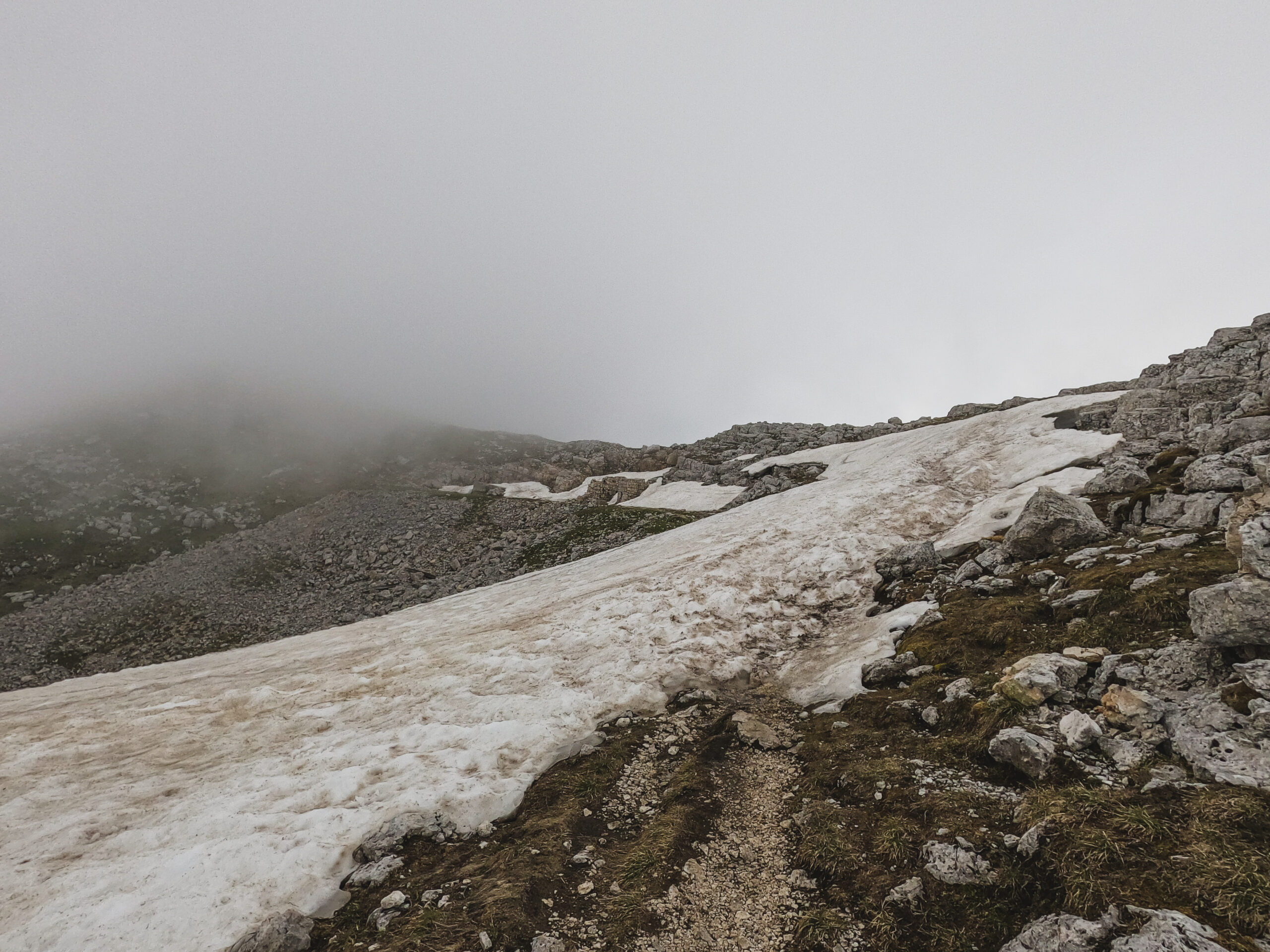
This is the snow section that I went around – I went up and to the right and rejoined the trail after the snow ended
Other hikes you might enjoy
- How To Hike The Sentiero Monte Cengio In Asiago, Vicenza
- How To Hike The Sentiero Del Forte Hike In Enego, Vicenza
- A Complete Guide To The Ponte Avis Hiking Trail And Suspension Bridge
- A Practical Guide On How To Hike The 52 Tunnels Trail In Italy
If you found this useful, return the favor by sharing it or following me on Instagram!
… [Trackback]
[…] There you will find 50534 more Information on that Topic: thekatieshowblog.com/how-to-hike-cima-portule/ […]
… [Trackback]
[…] Info on that Topic: thekatieshowblog.com/how-to-hike-cima-portule/ […]
… [Trackback]
[…] There you can find 2986 additional Info to that Topic: thekatieshowblog.com/how-to-hike-cima-portule/ […]
… [Trackback]
[…] Read More on that Topic: thekatieshowblog.com/how-to-hike-cima-portule/ […]
… [Trackback]
[…] Find More Info here to that Topic: thekatieshowblog.com/how-to-hike-cima-portule/ […]
… [Trackback]
[…] Find More Info here to that Topic: thekatieshowblog.com/how-to-hike-cima-portule/ […]
… [Trackback]
[…] Here you can find 14728 additional Information on that Topic: thekatieshowblog.com/how-to-hike-cima-portule/ […]
… [Trackback]
[…] Find More here on that Topic: thekatieshowblog.com/how-to-hike-cima-portule/ […]
… [Trackback]
[…] Here you can find 74110 more Information to that Topic: thekatieshowblog.com/how-to-hike-cima-portule/ […]
… [Trackback]
[…] Info to that Topic: thekatieshowblog.com/how-to-hike-cima-portule/ […]
… [Trackback]
[…] Find More Information here on that Topic: thekatieshowblog.com/how-to-hike-cima-portule/ […]
… [Trackback]
[…] Read More on that Topic: thekatieshowblog.com/how-to-hike-cima-portule/ […]
… [Trackback]
[…] Read More to that Topic: thekatieshowblog.com/how-to-hike-cima-portule/ […]
… [Trackback]
[…] Find More on that Topic: thekatieshowblog.com/how-to-hike-cima-portule/ […]
… [Trackback]
[…] Read More to that Topic: thekatieshowblog.com/how-to-hike-cima-portule/ […]
… [Trackback]
[…] Here you can find 80187 more Information on that Topic: thekatieshowblog.com/how-to-hike-cima-portule/ […]
… [Trackback]
[…] Find More Info here on that Topic: thekatieshowblog.com/how-to-hike-cima-portule/ […]
… [Trackback]
[…] Info to that Topic: thekatieshowblog.com/how-to-hike-cima-portule/ […]
… [Trackback]
[…] Read More on that Topic: thekatieshowblog.com/how-to-hike-cima-portule/ […]
… [Trackback]
[…] Info on that Topic: thekatieshowblog.com/how-to-hike-cima-portule/ […]