A mountain hike, epic cliff views, WWI trenches, and tunnels – the Sentiero Monte Cengio has everything. It’s a little tricky to write about because there are so many hikes in the area, options on how to get to the top of the mountain, and detours along the way. Much more than what I’ve listed in this guide. It’s my intention to give you a few options, and then you at least have an idea of what to expect and a couple of ways of doing the hike but just know there is more out there.
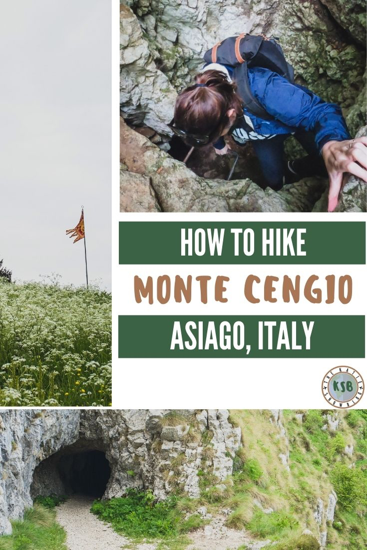
How To Hike The Sentiero Monte Cengio In Asiago, Vicenza
Disclaimer
There are affiliate links included in this post. This means at no extra cost to you, I earn a commission if you book through the link.
FAQ for hiking Monte Cengio
Where is it located?
Asiago, just under an hour from Ederle.
What skill is required?
Beginner.
How long does it take?
About 5 hours for the full loop depending on your pace.
Why type of trail is it?
It can be a point to point or a loop trail.
Are dogs allowed?
Yes.
Is it kid-friendly?
Yes – it depends on the kids. You know yours best so use the guide below to decide if it’s suitable for your family.
What facilities are available?
Agriturismo and rifugio along the trail if you want to stop for food.
What should you bring with you?
- Water
- Snacks, lunch, or energy gels – I always have a few of these with me
 for hikes
 - Flashlight – I used my phone light but if you’re nervous in tunnels, perhaps bring a flashlight
- Camera – GoPro is perfect for outdoor adventures and I use mine with this compact selfie stick and tripod
- Light jacket
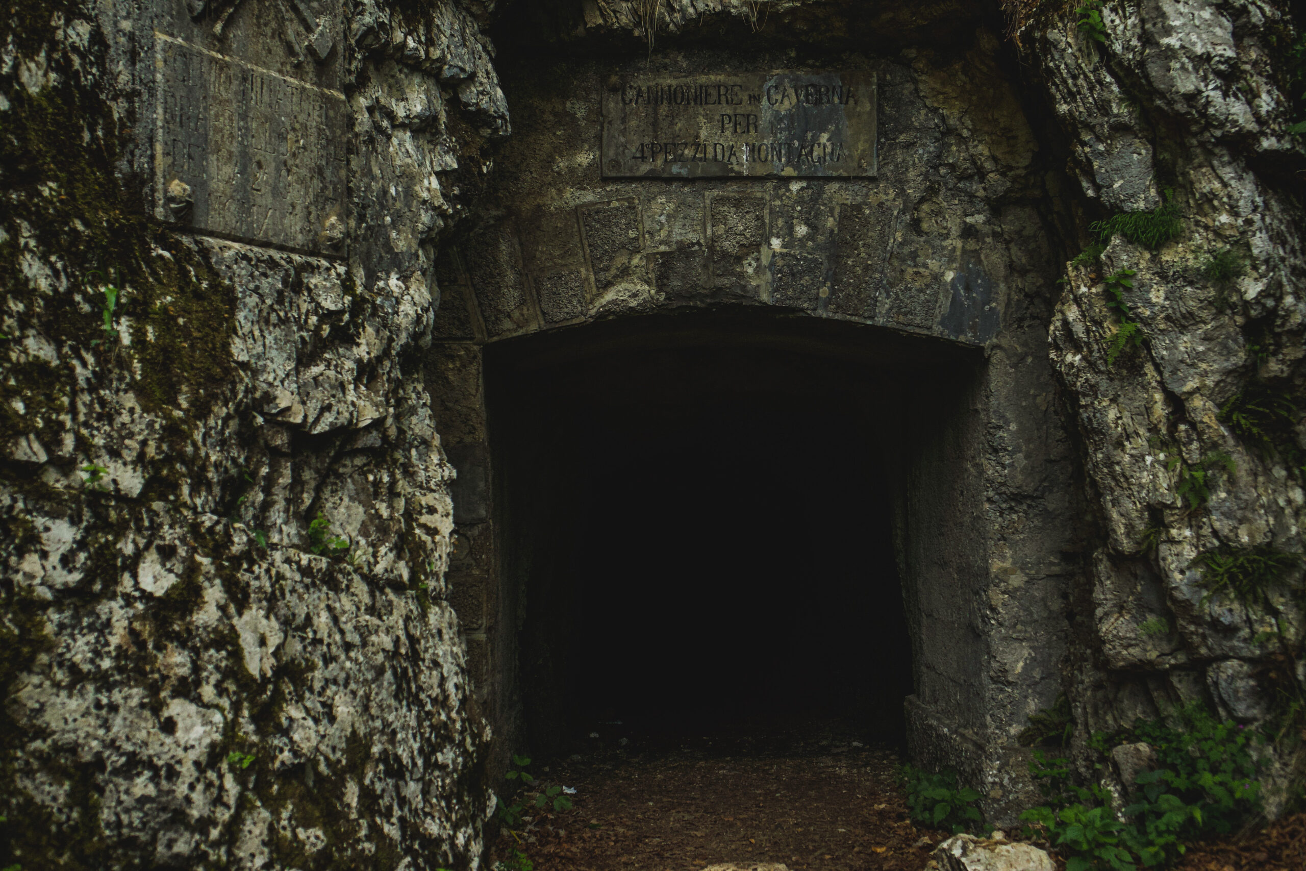
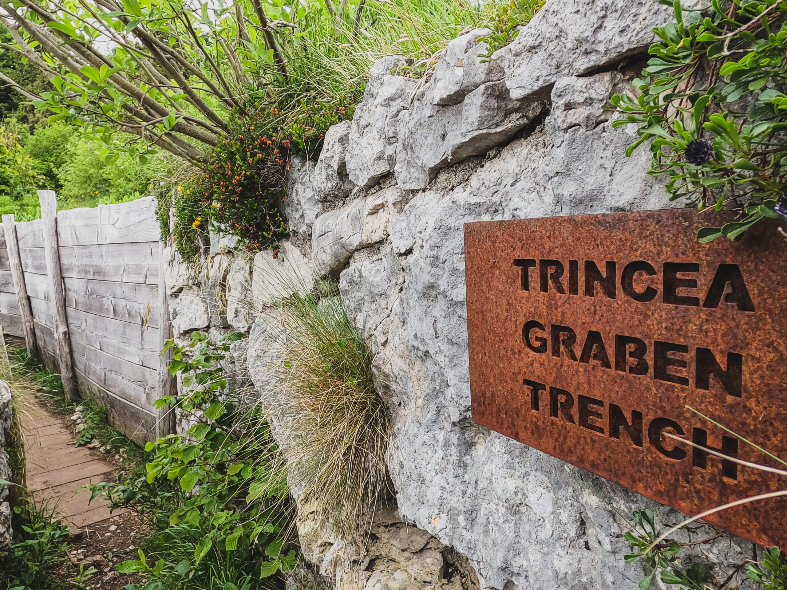
Exploring the WWI forts is one of the things that makes sentiero Monte Cengio unique.
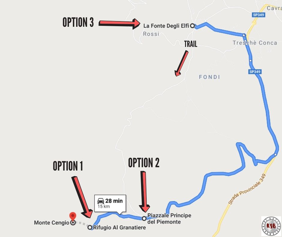
Options for where to park for the trail
You have a couple of options available to you as far as where to start the trail and it really depends on how much walking you want to do.
Option 1 – least amount of walking
Park at Rifugio Al Granatiere.
Option 2 – medium amount of walking
Park at Piazzale Principe del Piemonte.
Option 3 – long walk
Park at La Fonte Degli Elfi.
What to expect on the hike to Monte Cengio
I’m writing the guide for option 3 and will mention where 1 and 2 begin during the post so you can get an idea of what to expect for all options.
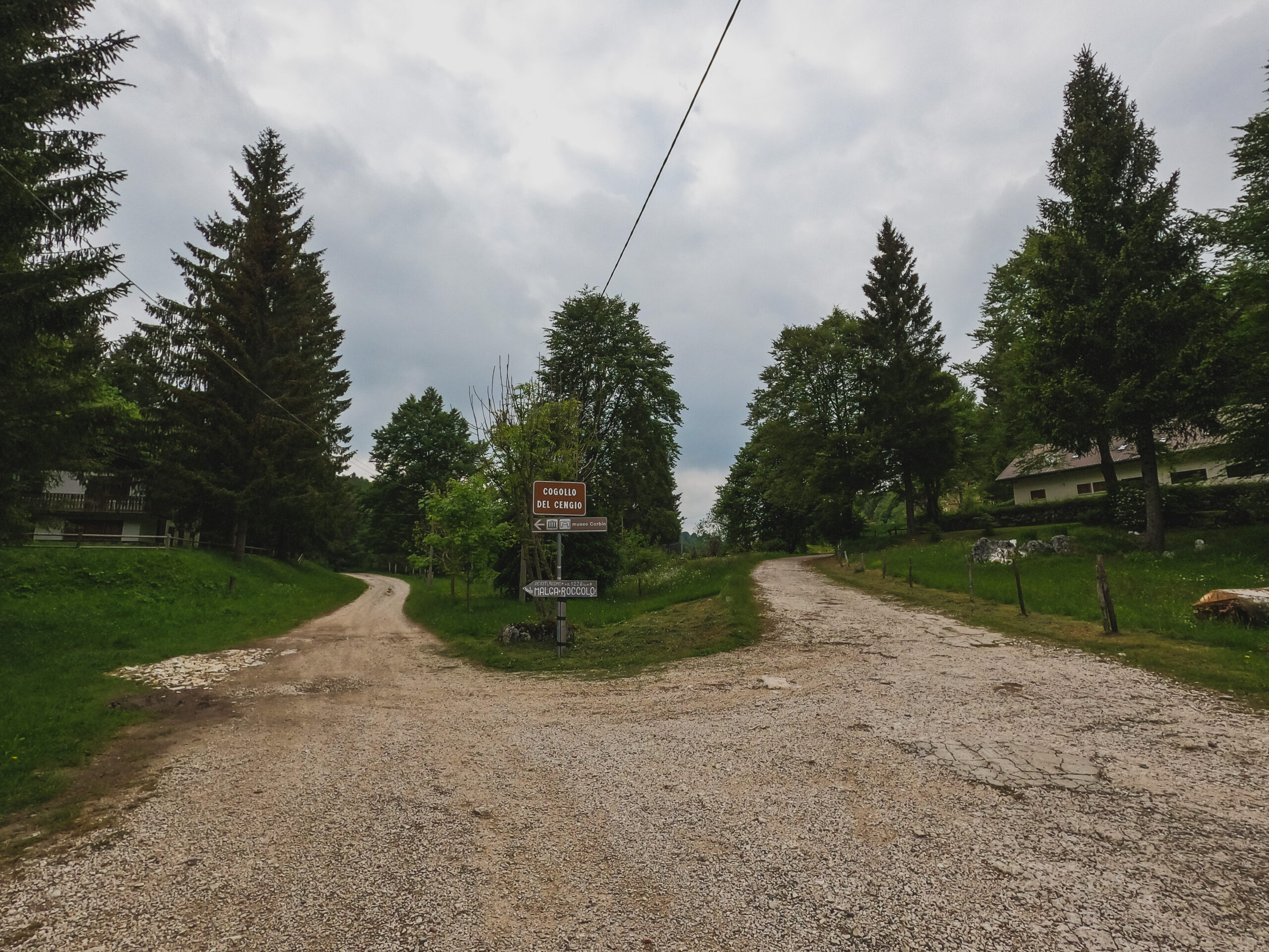
For the start of option 3, park at La Fonte Degli Elfi and then walk down Via Granatieri del Cengio.
Follow the signs for Monte Cengio and Forte Corbin and follow the road until you reach the fork in the road pictured below – the left fork has a sign for ‘Agriturismo Malga Roccolo and Monte Cengio’.
I took the left fork uphill to get to Monte Cengio.
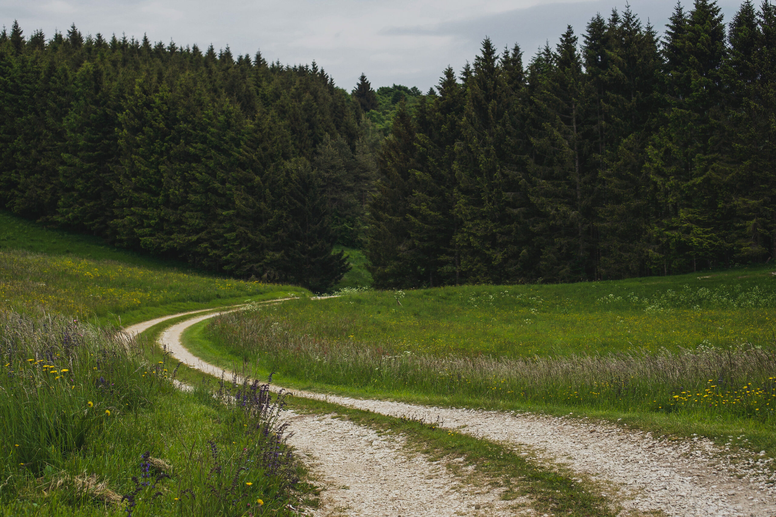
Most of this leg of the trail, until you link to where option 2 begins, is walking on the asphalt or gravel roads with scenic views.
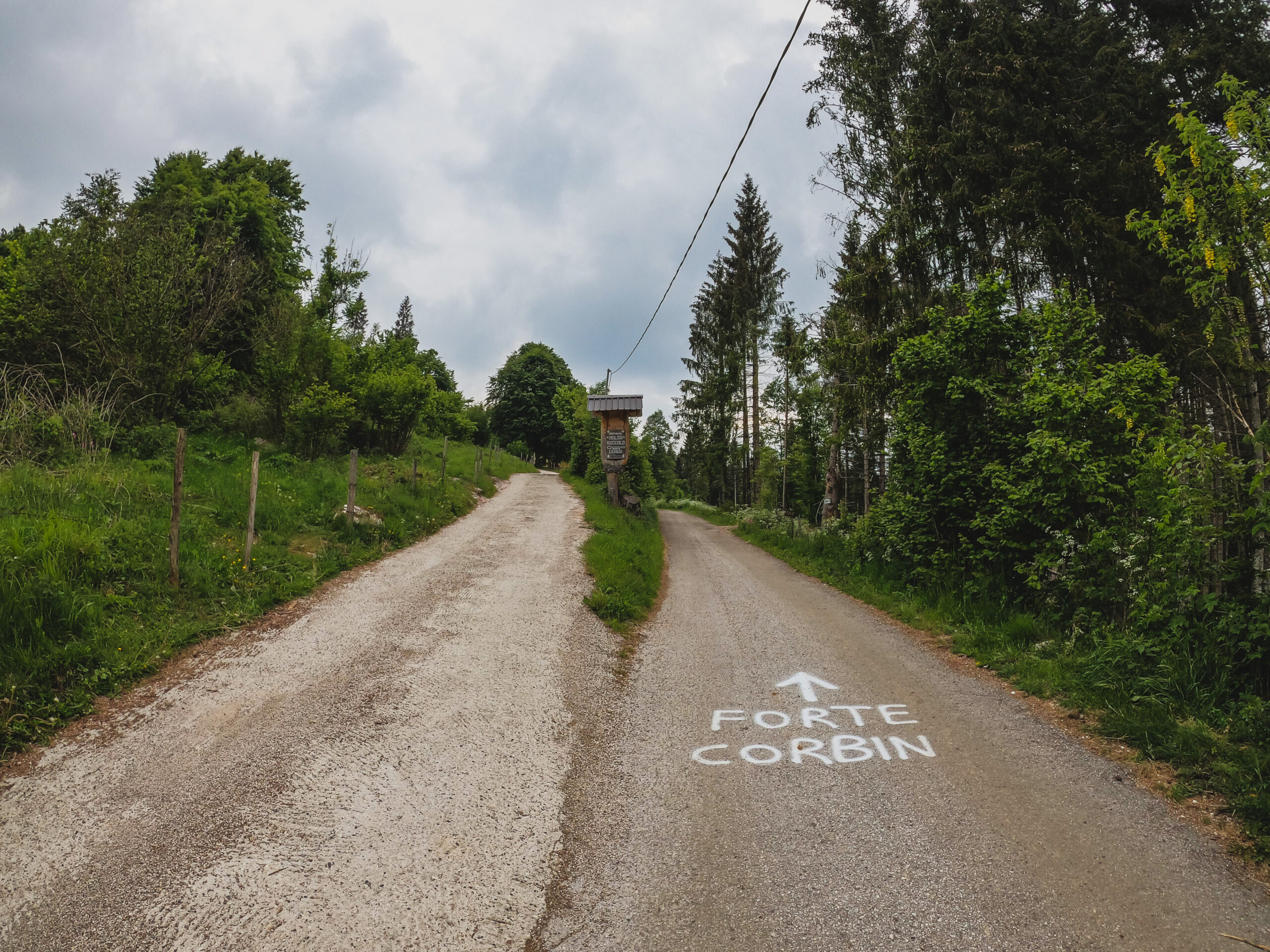
Forte Corbin
If you don’t want to do the rest of the hike, another option is to keep going right at the fork and visit the Forte Corbin fortress which is now a museum.
There is an entrance fee of €5 per adult. There is parking at the museum so you could drive if you prefer.
Here is the Forte Corbin website for more information.
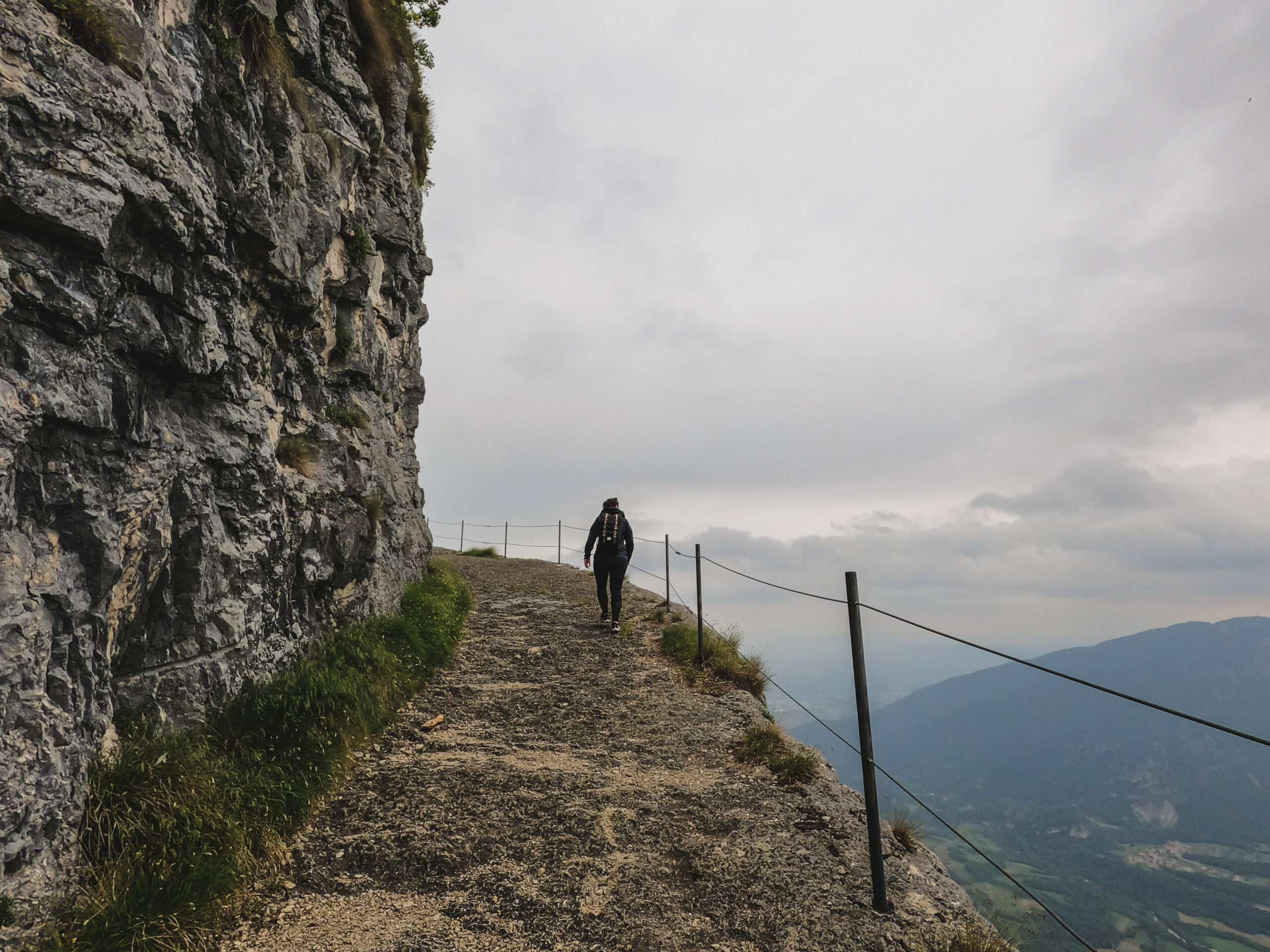
Views on the trail
Hiking from Piazzale Principe del Piemonte
Once you reach Piazzale Principe del Piemonte the terrain begins to change and it gets a little more interesting.
From the Piazzale Principe del Piemonte, follow the signs to Monte Cengio and Gallerie.
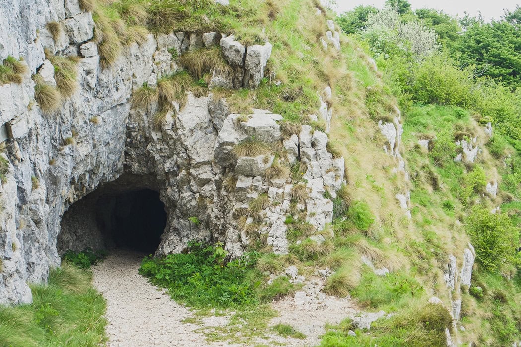
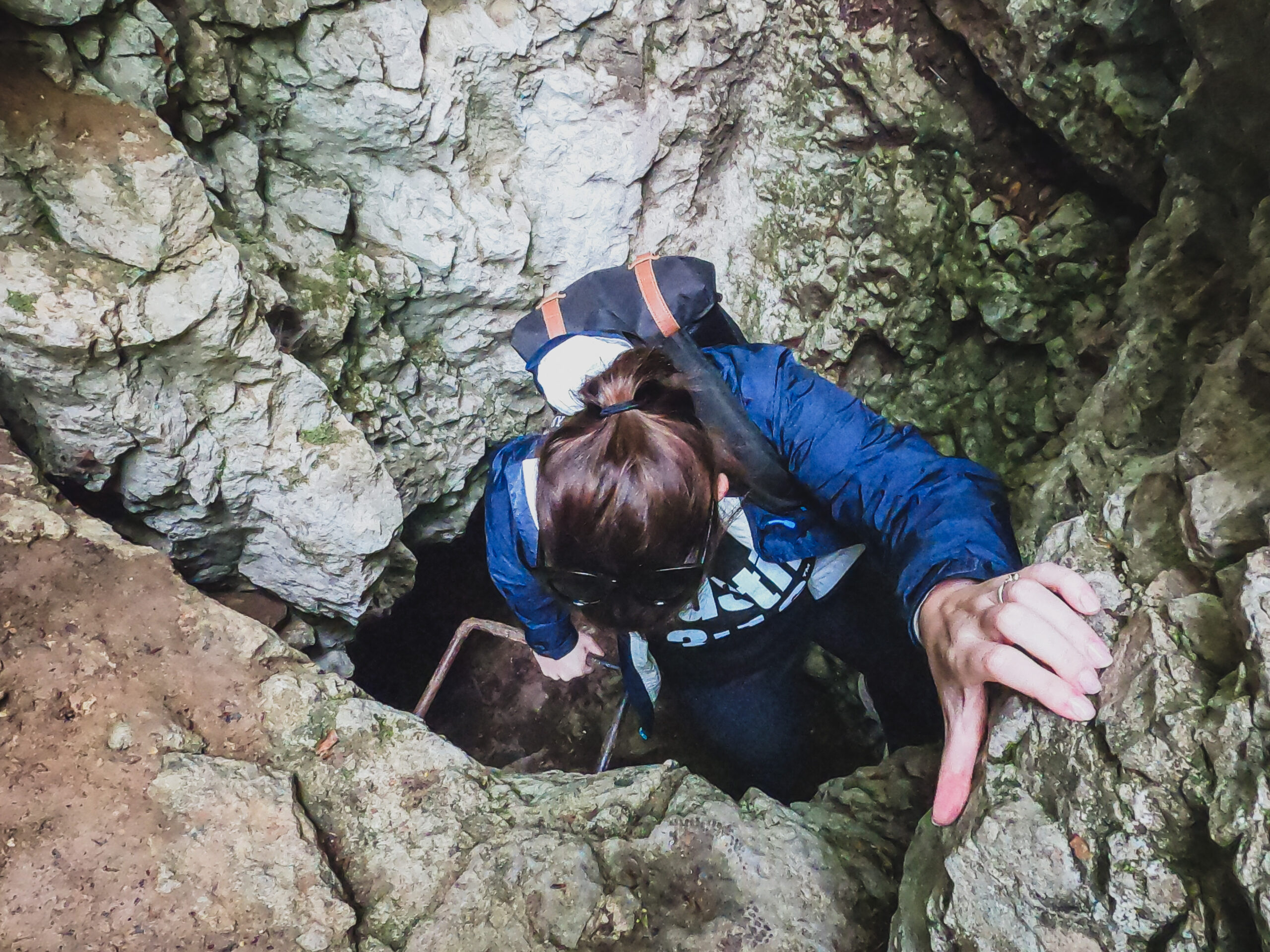
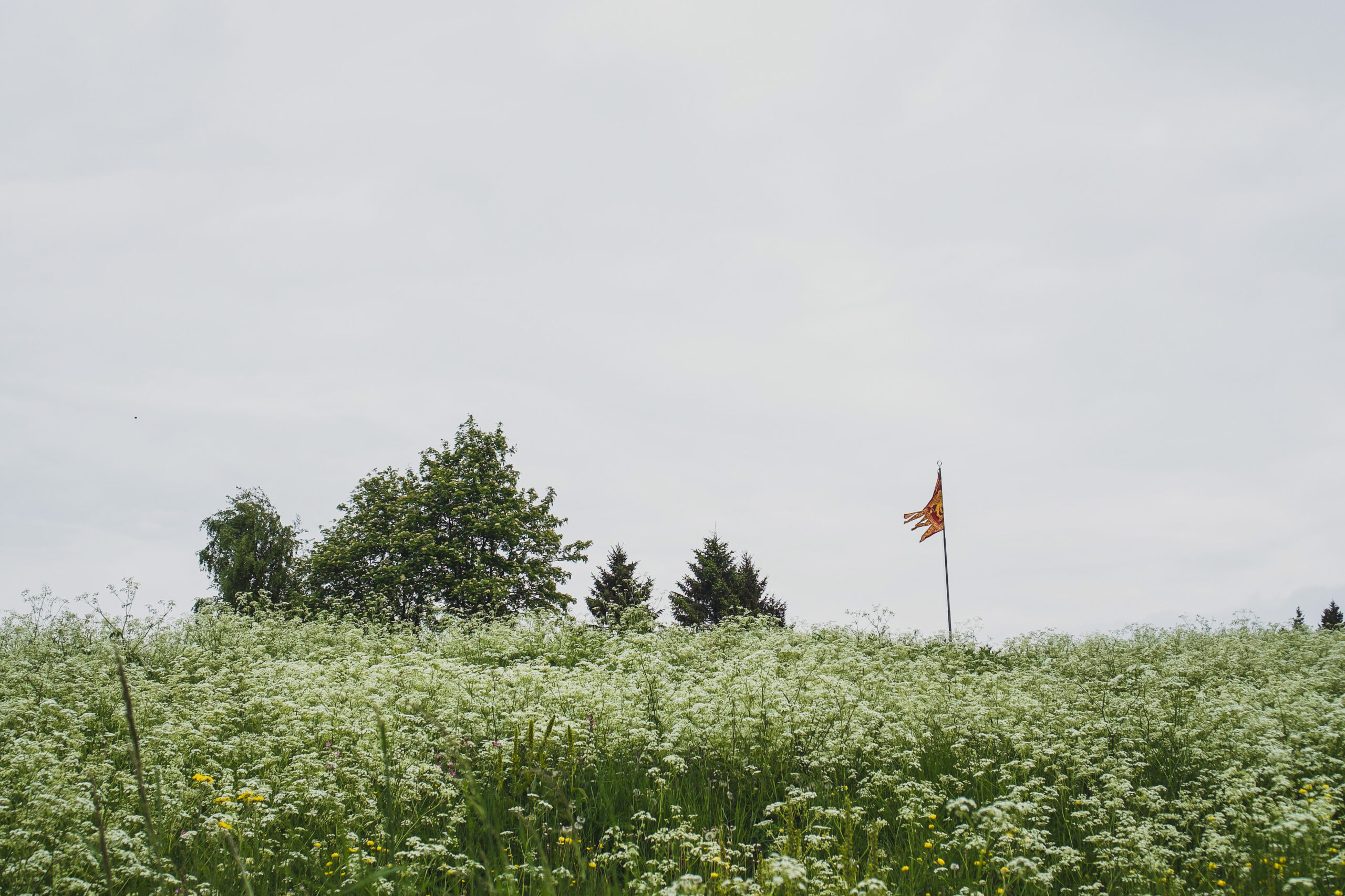
In this leg of the hike, you can explore a number of WWI forts, tunnels, trenches, and monuments. They are well signed so you can learn about them as you move along in the hike.
I got through all of the tunnels using just my phone light, but if you are uncomfortable in dark spaces or have young children, you may want to bring a flashlight.
During this leg of the trail, you also get to hike along the edge of the mountain with some pretty epic views. The ledge is wide, so if you are afraid of heights you don’t need to be close to the edge.
Finally, you will reach the Rifugio Al Granatiere which begins the final leg of the hike.
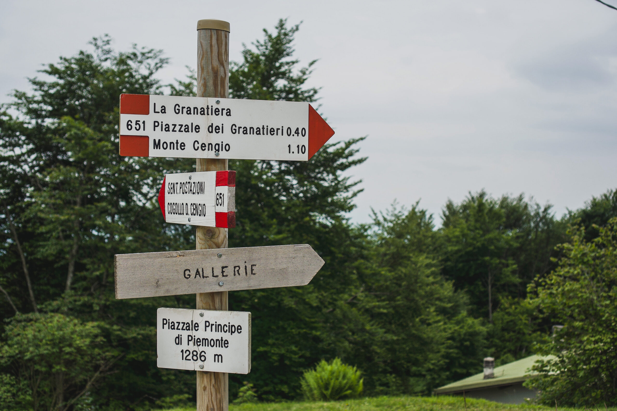
Signs to look out for – from here you’re following the signs to Monte Cengio and Gallerie
Hiking from Rifugio Al Granatiere
If you have older parents visiting or have kids that don’t like hiking, it’s probably easiest to start from here.
There is a monument by the rifugio then you can follow the path up to the summit. It’s all well signed and easy to follow.
At the top, there is a monument as well as a lot of open space with great views so it’s a nice spot to stop for a snack before heading back down the mountain.
On the way to the summit, there are more tunnels to look through as well.
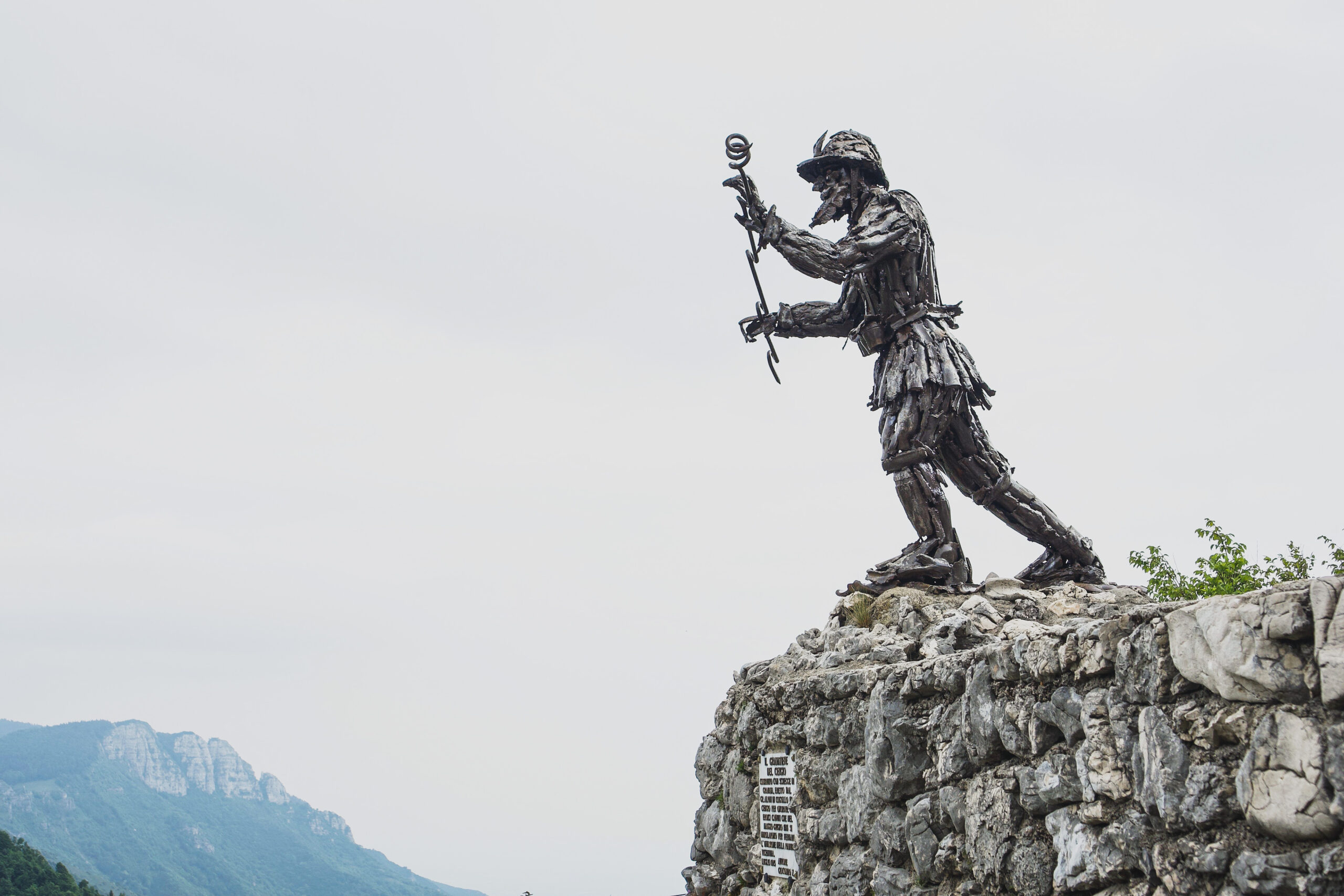
Monument near Rifugio Al Granatiere
Returning to La Fonte Degli Elfi
You can return to La Fonte Degli Elfi exactly the way you came, or there are a couple of options to turn it into a loop trail.
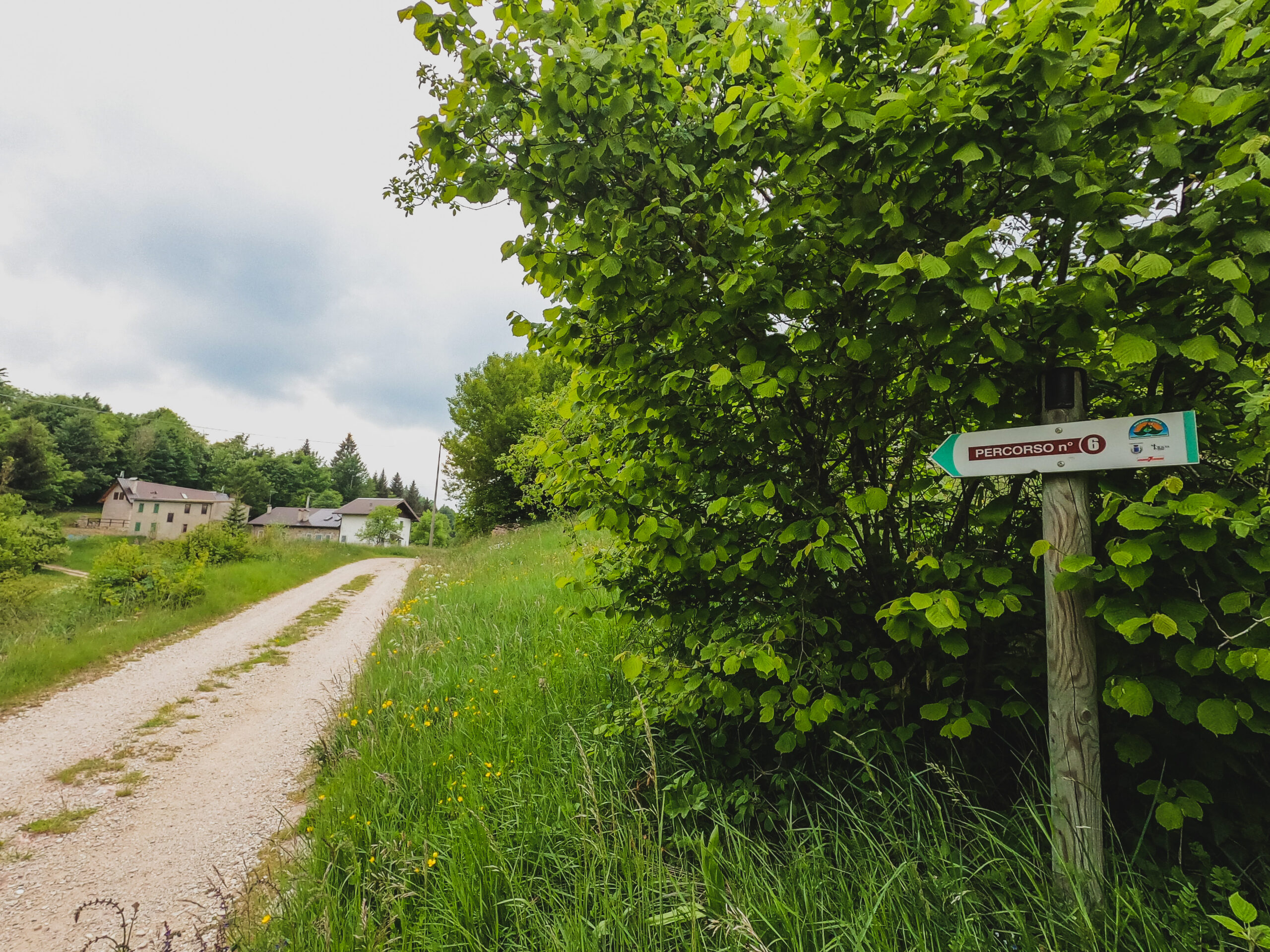
I went back the way I came until I reached Piazzale Principe del Piemonte. Then, if you are facing the chapel, I took the main road on the right downhill. It is basically straight ahead from the way you would’ve come up to first reach Piazzale Principe del Piemonte.
Follow the signs for the Agriturismo Malga Roccolo and Doing this loop will bring you out to the fork in the road near the agriturismo.
From there, you can walk back to your car the same way you came.
Trail on the way back
It’s easy to follow the signs to the Agriturismo on the way back
Safety tips for the Monte Cengio hike
Given the higher altitude, bring a jacket in case you get cold and check the weather before you go so you can be prepared on the day.
Along that note, hikes like sentiero Monte Cengio at higher altitudes can be more taxing so just take it at your own pace and rest if you need to.
As with any hike, allow enough time to be back before dark, follow the trail and pack enough water and food.
Other guides for adventures in Vicenza
- How To Hike The Sentiero Del Forte Hike In Enego, Vicenza
- A Complete Guide To The Ponte Avis Hiking Trail And Suspension Bridge
- A Complete Guide For The Croce Di Lumignano Hike in Vicenza
- A Practical Guide On How To Hike The 52 Tunnels Trail In Italy

If you found this useful, return the favor by sharing it or following me on Instagram!
About how long does the hike take from Piazzale Principe del Piemonte? Or how far is it?
Maybe about 40 minutes?? Depends on how long you stop for photos and looking at the views but (and this is from memory) but I think about 40 minutes or so
… [Trackback]
[…] Find More Info here on that Topic: thekatieshowblog.com/sentiero-monte-cengio/ […]
… [Trackback]
[…] Find More on that Topic: thekatieshowblog.com/sentiero-monte-cengio/ […]
… [Trackback]
[…] Info on that Topic: thekatieshowblog.com/sentiero-monte-cengio/ […]
… [Trackback]
[…] Here you will find 37370 more Info on that Topic: thekatieshowblog.com/sentiero-monte-cengio/ […]
… [Trackback]
[…] There you can find 87539 more Information on that Topic: thekatieshowblog.com/sentiero-monte-cengio/ […]
… [Trackback]
[…] Info to that Topic: thekatieshowblog.com/sentiero-monte-cengio/ […]
… [Trackback]
[…] Read More Information here to that Topic: thekatieshowblog.com/sentiero-monte-cengio/ […]
… [Trackback]
[…] Find More here to that Topic: thekatieshowblog.com/sentiero-monte-cengio/ […]
… [Trackback]
[…] Read More Info here on that Topic: thekatieshowblog.com/sentiero-monte-cengio/ […]
… [Trackback]
[…] Information on that Topic: thekatieshowblog.com/sentiero-monte-cengio/ […]
… [Trackback]
[…] Read More Info here to that Topic: thekatieshowblog.com/sentiero-monte-cengio/ […]
… [Trackback]
[…] Find More here on that Topic: thekatieshowblog.com/sentiero-monte-cengio/ […]
… [Trackback]
[…] Here you will find 97097 more Information on that Topic: thekatieshowblog.com/sentiero-monte-cengio/ […]
… [Trackback]
[…] Read More here on that Topic: thekatieshowblog.com/sentiero-monte-cengio/ […]
… [Trackback]
[…] There you can find 84635 more Info to that Topic: thekatieshowblog.com/sentiero-monte-cengio/ […]
… [Trackback]
[…] Information on that Topic: thekatieshowblog.com/sentiero-monte-cengio/ […]
… [Trackback]
[…] Find More on that Topic: thekatieshowblog.com/sentiero-monte-cengio/ […]
… [Trackback]
[…] Info to that Topic: thekatieshowblog.com/sentiero-monte-cengio/ […]
… [Trackback]
[…] Info to that Topic: thekatieshowblog.com/sentiero-monte-cengio/ […]
… [Trackback]
[…] Here you can find 97300 additional Info to that Topic: thekatieshowblog.com/sentiero-monte-cengio/ […]
… [Trackback]
[…] Find More on on that Topic: thekatieshowblog.com/sentiero-monte-cengio/ […]
… [Trackback]
[…] Read More on on that Topic: thekatieshowblog.com/sentiero-monte-cengio/ […]
… [Trackback]
[…] Information on that Topic: thekatieshowblog.com/sentiero-monte-cengio/ […]
… [Trackback]
[…] Here you can find 93838 more Information on that Topic: thekatieshowblog.com/sentiero-monte-cengio/ […]
… [Trackback]
[…] Here you can find 95323 additional Information to that Topic: thekatieshowblog.com/sentiero-monte-cengio/ […]
… [Trackback]
[…] Read More here on that Topic: thekatieshowblog.com/sentiero-monte-cengio/ […]
… [Trackback]
[…] Read More on that Topic: thekatieshowblog.com/sentiero-monte-cengio/ […]
… [Trackback]
[…] Read More Info here to that Topic: thekatieshowblog.com/sentiero-monte-cengio/ […]
… [Trackback]
[…] Find More on that Topic: thekatieshowblog.com/sentiero-monte-cengio/ […]
… [Trackback]
[…] Read More Info here to that Topic: thekatieshowblog.com/sentiero-monte-cengio/ […]